Getting the pole positions
The U's experts at mapping Antarctica expand their work to the Arctic
Pictures of the Arctic and Antarctic can barely do justice to the beauty of mile-wide glaciers flowing between jagged mountains or sculpted white ice floating in an azure sea.
In these days of global climate change, however, monitoring the state of these near-pristine ecosystems is more important than ever.
Doing this requires knowledge of polar landscapes, plus the ability to identify and track changes in features ranging from glaciers and meltwater lakes to Weddell seal and penguin populations. For that, researchers around the nation turn to Paul Morin and his staff at the University of Minnesota's Polar Geospatial Center (PGC).
For five years the PGC (formerly the Antarctic Geospatial Information Center), with National Science Foundation (NSF) funding, has supplied maps, logistical support, and training to U.S. researchers in Antarctica. Now it will do the same in the Arctic, thanks to a new five-year, nearly $4 million cooperative agreement with NSF.
"We're the people that are asked very specific logistics questions, and we're funded to help NSF-funded people," says Morin, director of PGC. "When they have a geospatial problem in the Arctic or Antarctic, they come to us."
PGC staff produce tailor-made maps that researchers and logistics experts in the U.S. Antarctic Program depend on daily. Morin will use images from any satellite belonging to any country, and many of his team's maps are "firsts."
For instance, Morin and his staff, along with researchers in the United States and around the world, used high-resolution satellite imagery to conduct the first census of emperor penguins. They've shown that the imagery can also be used to count Weddell seals.
Besides studying penguins or seals remotely, researchers and logisticians may need the help of maps to find interesting outcroppings of rocks, measure how far a glacier has receded, or learn whether a boulder is blocking a path. And, of course, to show where the crevasses are.
"We use GPS to find exactly where certain reference points are," says PGC research associate Claire Porter. "This allows us to make more accurate maps."
Their work has drawn the attention of some famous names. Through a partnership with Google, they will keep polar data up to date in Google Earth and Google Maps of the Arctic and Antarctic. The PGC is also contributing remote sensing expertise to David Attenborough's upcoming BBC documentary, "Frozen Planet."
Walking the walk
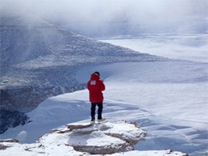
The PGC staff of 10, including several undergraduates, have traveled to the ends of the Earth to do hands-on surveying and mapping. In Antarctica, they work in the McMurdo Dry Valleys, a mountainous, rainless, 12,740-square-mile region whose rocky crags have been sculpted by wind for millions of years. Some of its valleys have lakes formed by glacial melt; these are of interest because their levels reflect the amount of melting tied to global climate change.
Last July Morin and Porter traveled to the west coast of Greenland. One object of their trip was to set up experiments to track, via satellite, the velocity of ice movements. These movements give vital information about glacial melting, because the more bottom ice melts out from a glacier, the more it lubricates the glacier's path and speeds up its flow.
"The fastest Greenland glaciers we know can move seven meters per day," Porter notes.
With the new NSF funding, PGC staff can help scientists follow changes to arctic landscapes, seascapes, and animal distributions. In addition to their direct effects on the Inuit people, these and similar changes in the Antarctic have the potential to influence life everywhere on our planet.
"We're the people that are asked very specific logistics questions, and we're funded to help NSF-funded people," says Morin, director of PGC. "When they have a geospatial problem in the Arctic or Antarctic, they come to us."
PGC staff produce tailor-made maps that researchers and logistics experts in the U.S. Antarctic Program depend on daily. Morin will use images from any satellite belonging to any country, and many of his team's maps are "firsts."
For instance, Morin and his staff, along with researchers in the United States and around the world, used high-resolution satellite imagery to conduct the first census of emperor penguins. They've shown that the imagery can also be used to count Weddell seals.
Besides studying penguins or seals remotely, researchers and logisticians may need the help of maps to find interesting outcroppings of rocks, measure how far a glacier has receded, or learn whether a boulder is blocking a path. And, of course, to show where the crevasses are.
"We use GPS to find exactly where certain reference points are," says PGC research associate Claire Porter. "This allows us to make more accurate maps."
Their work has drawn the attention of some famous names. Through a partnership with Google, they will keep polar data up to date in Google Earth and Google Maps of the Arctic and Antarctic. The PGC is also contributing remote sensing expertise to David Attenborough's upcoming BBC documentary, "Frozen Planet."
Walking the walk
The PGC staff of 10, including several undergraduates, have traveled to the ends of the Earth to do hands-on surveying and mapping. In Antarctica, they work in the McMurdo Dry Valleys, a mountainous, rainless, 12,740-square-mile region whose rocky crags have been sculpted by wind for millions of years. Some of its valleys have lakes formed by glacial melt; these are of interest because their levels reflect the amount of melting tied to global climate change.
Last July Morin and Porter traveled to the west coast of Greenland. One object of their trip was to set up experiments to track, via satellite, the velocity of ice movements. These movements give vital information about glacial melting, because the more bottom ice melts out from a glacier, the more it lubricates the glacier's path and speeds up its flow.
"The fastest Greenland glaciers we know can move seven meters per day," Porter notes.
With the new NSF funding, PGC staff can help scientists follow changes to arctic landscapes, seascapes, and animal distributions. In addition to their direct effects on the Inuit people, these and similar changes in the Antarctic have the potential to influence life everywhere on our planet.