Smartphone research aims to help visually impaired pedestrians
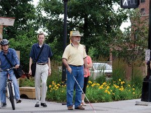
Crossing a street isn’t risk-free for any pedestrian, but it’s especially challenging for the blind or visually impaired.
Chen-Fu Liao, senior systems engineer in the U’s Minnesota Traffic Observatory, led a research team that developed a prototype Mobile Accessible Pedestrian Signal (MAPS) system using a smartphone, GPS, and other technologies to help people with limited or no eyesight cross signalized intersections safely.
For their work, funded by the Intelligent Transportation Systems Institute (a part of CTS), the researchers interviewed 10 blind and low-vision people to better understand what types of information they use at intersection crossings and to identify what could help them. “I think the whole system and the whole concept is so beautiful,” says Ken Rodgers, president of the American Council for the Blind of Minnesota. “It just works well.”
- 25 million Americans 18 and older have significant vision loss.
- More than 3.4 million Americans age 40 and older are legally blind or visually impaired.
- Every 7 minutes someone in the U.S. becomes blind or visually impaired.
Blind or visually impaired pedestrians face a number of challenges, such as difficulty locating the edge of the street or crosswalk and interpreting signal and traffic patterns. Current crossing systems, which use audio warnings, have shortcomings for municipalities, including the cost of equipment and maintenance. And because there is no standard location for push-button signals, visually impaired pedestrians must deviate from their preferred travel paths to request a crossing signal, which can make navigating the intersection more difficult.
The U’s system goes above and beyond existing crosswalk aids. While standing at an intersection, the user can point a smartphone in the direction he or she wants to cross and call up information about the intersection and the signal phase by tapping the unit’s touchscreen once. Tapping twice confirms the desired crossing direction and sends a request for a crossing signal to the traffic signal controller. The user gets feedback from the text-to-speech interface.
Because it’s an app, it’s easy and inexpensive for users. And MAPS puts the assistive technology directly in the hand of the user, avoiding many of the drawbacks associated with conventional infrastructure-based systems while offering greater flexibility and ease of use. A video explaining MAPS is online.
The prototype has been field-tested at intersections in Minneapolis and Golden Valley, Minnesota. Work continues to refine the accuracy, resolution, and usability of the system.
In addition, the researchers will soon begin a new project funded by the Minnesota Department of Transportation. This project aims to enhance the system to help the visually impaired travel safely around work zones.
This story has been reprinted from the Center for Transportation's CTS Catalyst with permission.