U researcher unveils 'geowiki' for cyclists
A University graduate researcher has developed a nifty new Web site for bicyclists
By Rick Moore
For the average driver using the handy Web site MapQuest, directions are pretty cut and dried. If you have a problem getting from Point A to Point B, chances are that it's user error.
For a bicyclist such as myself, getting from Point A (home) to Point B (work) isn't nearly as simple. Sure, I could take Cedar Avenue, as MapQuest would tell me to do in a car, but chances are I would either A) be hit by a car traveling in one of the two narrow northbound lanes, or B) inspire some driver to dream of running me over because he has to slow down until he can find an opening to pass.
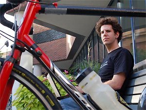
But University graduate researcher Reid Priedhorsky has developed a new tool that stands to make two-wheeled journeys more expedient and more enjoyable. It's a Web site called Cyclopath.org, which Priedhorsky dubs a "geowiki." The "geo" refers to its function as a map, while the "wiki" refers to the ability for users to make changes to the content.
The site gives cyclists a host of options. They can get recommendations on how to best navigate the Twin Cities (based on variables such as distance and "bikeability"); they can make changes to erroneous or outdated map information; and they can comment (for the benefit of other users) on the conditions of the roads and trails they travel like "Watch out for the potholes near the bike lane" or "Lift your bike over the railroad tracks and look for the shortcut."
Cyclopath.org entered its beta phase on August 30, meaning there might still be some software glitches on the horizon, but Priedhorsky says that so far the rollout has gone well, and users have given him great feedback. "It's been pretty positive," he says. "We've been really pleased."
A geowiki built from scratch
The idea for a geowiki for the biking community had been cycling through Priedhorsky's head for some time, dating back to a conversation he had with Doug Shidell, who since 1984 has published the Twin Cities Bike Map book.
"We chatted about what can be done on the Internet with maps," Priedhorsky says. "You can critique a paper map, [and when you do] the wiki idea comes right out of it."
And it's right up his academic alley. Priedhorsky is starting his sixth year as a Ph.D. student in computer science, and one of his primary interests is in online communities. But that's not to say the project has been easy, especially once he determined he couldn't use Google or Yahoo interfaces.
"We had to do it from scratch, and that took longer than my younger and very enthusiastic mind thought it would," jokes Priedhorsky, who showed off the features of the site wearing a t-shirt that said "No, I will not fix your computer."
The Minnesota Department of Transportation gave Cyclopath seed data from maps of streets and bikeways. "The two data sets don't fit well together, but with the wiki, people can go in and fix the areas they're familiar with," he says. They can also access an aerial view of the Twin Cities via detailed images from the U.S. Geological Survey.
Users can manually connect roads and pathways that should be connected or disconnect those that shouldn't. (The computer server then absorbs that new information and incorporates it into an updated map.) They can add landmarks of interest like water fountains, bike shops, and cafes. They can also rate streets block by block and add whatever editorial comments they deem germane.
For instance, I immediately zoomed in on what I know to be a trouble spot an intersection just north and east of the new Martin Olav Sabo Bridge (over Hiawatha Avenue) where the LRT trail crosses 26th Street. Automobile drivers there are generally aware of the situation, but some turning onto 26th from Hiawatha don't have the time or space to stop for bikes. Sure enough, someone else had beaten me to the comment:
"The intersection at 26th is very dangerous (triple jeopardy)."
Priedhorsky received funding for the site from the National Science Foundation, and says that as part of his research he'll be exploring questions about geographic wikis in general, including "How do people interact on a geographic wiki site and how is that different from a text wiki like Wikipedia?"
An editorial staff of millions
He says he's not sure about the future growth of Cyclopath, but options might include expanding the site in Minnesota beyond the seven-county metro area or spinning off in other cities, such as Chicago or bike-friendly Portland, Oregon.
Ultimately, its users will determine the site's success in this case, an editorial staff of potentially millions of people. And some, it would appear, have the potential to be prolific contributors. "One of the users has made 1,000 changes by himself," notes Priedhorsky.
He adds that he's not particularly worried about geowiki "vandalism"; that is, the appearance of intentionally erroneous information. "I don't see people getting as excited about a map as they do about [other wiki subjects, like Sarah Palin]," he says. "I'm sure that her Wikipedia article is having a tough time right now [with vandalism], because there are a lot of people excited on both sides."
Priedhorsky hopes that Cyclopath stirs up more excitement about bicycling and its many benefits both for the health of riders and for the flow of metro traffic. Which relates to an interesting philosophy that guides Priedhorsky's work.
"We have a lot of technology these days, and it causes a lot of social problems," he says, noting that the American culture is very much automobile-based, which has led to issues like pollution, urban sprawl, etc. "I'd like to use technology to solve the social problems that were themselves caused by technology."