
Far-reaching Lake Superior Basin project receives NSF grant
August 2022 – An interdisciplinary group of experts recently received a 2.8 million dollar National Science Foundation Frontier Research in Earth Sciences grant to delve into the formation and evolution of the Lake Superior basin. The unique glacial and geological history of the Lake Superior region offers the team of nine lead scientists, spread across five universities, a "natural experiment" to study the structure of Earth's crust and mantle, the behavior of outlet glaciers from ice sheets, river erosion, and lake- and sea-level change.
"As scientists, we seek to understand the fundamental processes that set how nature behaves," says Professor Andrew Wickert of the University of Minnesota, who leads the collaboration. "The Lake Superior basin hosts beautiful and dynamic geology. Because of its unique history and formation, we can use it as a template to test our knowledge of the physics of the Earth and improve our predictions about changes in glaciers, landscapes, and Earth's structure across the world."
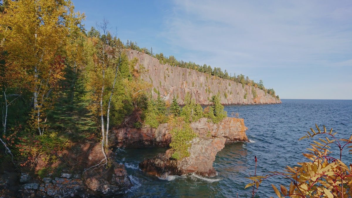
Photo credit: Andrew Wickert
In addition to pursuing multi-layered research within the Lake Superior basin, the project team will engage with Indigenous partners and mutual collaborators, integrating Indigenous ways of knowing into its research practices with the support of Native American colleagues from the Lac du Flambeau Band of Lake Superior Chippewa.
The project also partners with the Superior Hiking Trail Association (SHTA) to broadly share the experts’ findings. Roughly 10 million visitors explore Lake Superior’s North Shore and surrounding landscape each year – a diverse community of hikers, backpackers and day trippers enthusiastic to learn about this unique landscape.
The multiplicity of perspectives, academic disciplines and connections to community uniquely allow this project to advance fundamental research while expanding access to and engagement with science that is intimately grounded in place while offering insights that can be applied to landscapes around the world.
An expansive, multi-layered project
Approaching the Lake Superior basin as a complex and interconnected system, project experts will conduct research that reaches from the depths of the Earth’s mantle to its surface.
“The whole earth system is connected, from the 1500-degree Celsius rocks beneath our feet to the trees and water at the surface,” says Wickert, lead PI on the project. “Here in the Lake Superior basin, we can strive to understand all of these pieces together.”
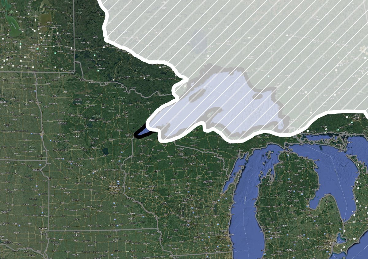
Map credit: Andrew Wickert
Beginning deep underground, co-PI Max Bezada (University of Minnesota, Twin Cities, Earth & Environmental Sciences) will use seismic waves from earthquakes across the world to map the structure of the earth under the Lake Superior basin. How quickly these waves "attenuate" – or gradually disappear into the background hum of Earth's vibrations – indicates how stiff or fluid Earth's crust and mantle are, and where.
With this new understanding of the structure beneath the lake, Institutional PI Jerry Mitrovica (Harvard, Earth and Planetary Sciences) will build and run models to simulate how and why the Lake Superior basin is tilting and warping. Ice and water are both heavy loads on Earth's surface. The weight of ice depressed the Lake Superior region during the last glacial period. As the basin continues to rise today, it is tilting towards the southwest, causing lake level to rise near Duluth and Superior.
Co-PI Andy Breckenridge (University of Wisconsin–Superior, Natural Sciences) will bring additional clarity to questions surrounding basin deformation by mapping and dating Lake Superior’s ancient shorelines. Over ten distinct shorelines are present in the basin, with the progressively older shorelines being more strongly uplifted and tilted. Some of these shorelines dive beneath the modern water level, and where this happens, river mouths are also being progressively drowned, causing a sharp transition from steep waterfalls to gentle streams with broad floodplains. Combining Breckenridge's mapping with Bezada's seismic waves and Mitrovica's modeling, the project team will reconstruct the shape of the Lake Superior basin over the past 13,000 years or more.
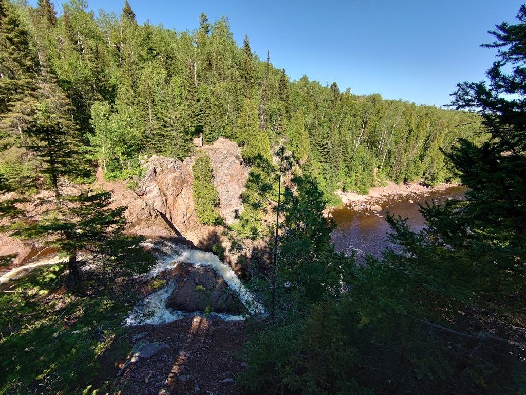
Photo credit: Andrew Wickert
This surface warping and lake-level change occurred at the same time as ice advanced into and retreated from Lake Superior. The Lake Superior basin is unique in that ice advanced in the basin when the climate was actually warming – a surprising discovery, given that water-terminating glaciers usually become unstable and break apart under warming conditions. Institutional PI Marianne Haseloff and co-PI Lucas Zoet (University of Wisconsin–Madison, Geoscience) will analyze different terrain features on the landscape to better understand how past glaciers disintegrated and what effect they had on today’s rivers. In investigating glaciation and its impacts on the Lake Superior basin, Haseloff and Zoet’s work will give new insights into the stability of the glaciers that flow from Greenland and Antarctica into the ocean. By advancing knowledge of how glaciers stabilize even when experiencing warmer temperatures, Haseloff and Zoet can better understand the various ways in which glaciers may react as climate change raises temperatures.
Institutional PI Phillip Larson (Minnesota State University, Mankato) will investigate the relationship between the recent deglacial history and the formation of rivers and their valleys on the North Shore of Lake Superior. In addition, his group will improve our understanding of two of the lake’s past water outlets. Larson and his students will date and interpret sediments and outcrops around Lake Superior. Through this, they will first build a chronology of water release to the St. Croix River valley and Lake Michigan. Once they know this timing, they will integrate their information with other team members to understand how these events shaped Lake Superior and the surrounding region.
Larson will be joined in this river work by Lead PI Andrew Wickert (University of Minnesota, Twin Cities, St. Anthony Falls Laboratory and Earth & Environmental Sciences) and co-PI Karen Gran (University of Minnesota Duluth, Earth & Environmental Sciences). Wickert and Gran will examine the rivers along the North and South Shores, many of which were exposed when glaciers retreated from the basin, causing the lake to fall by 200 meters (660 feet). Instead of running lab experiments, Wickert, Gran, and Larson will be able to directly investigate a real-world example of how water flowing over different materials over the course of time can shape a landscape. The team will then use these data to test and improve physics-based models for how rivers erode.
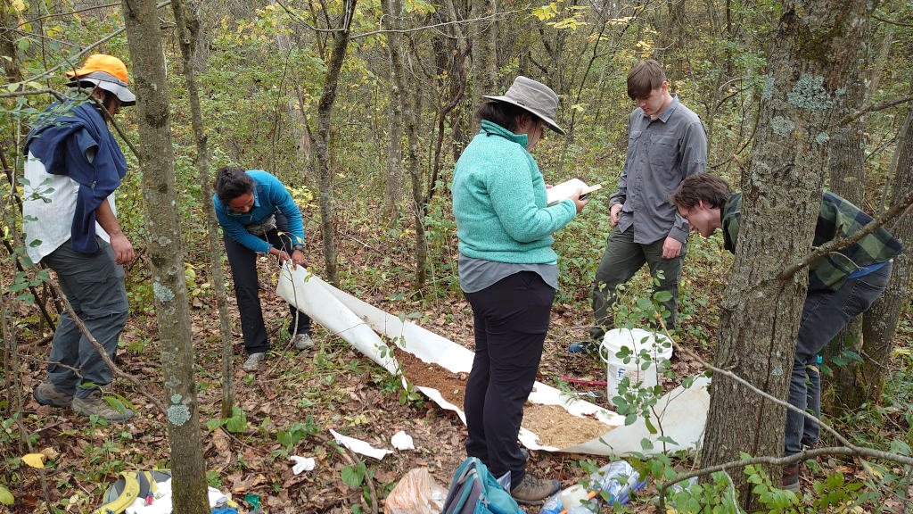
Photo credit: Andrew Wickert
Lastly, co-PI Keisha Varma (University of Minnesota, Twin Cities, Educational Psychology) will bring a unique lens to the project as she studies the researchers at work in the field. The geosciences are one of the least racially diverse STEM fields. While geoscientists often credit their experiences and friendships in the field as foundational to their vocation and success, these experiences can also close the door to individuals who have not had the opportunity, money, or equipment to explore nature. Through ethnographic surveys, Varma will take a critical look at field work, building recommendations to include and engage a broader community of researchers and to help educators to provide positive experiences for the full and diverse spectrum of students.
Research (and researchers) with an impact
With research that spans Earth’s mantle to its surface, this project will expand fundamental understanding across the fields of geomorphology, solid-Earth geophysics, and glacial systems science. While advancing knowledge on the natural world, the project team will work to build inclusive and inviting approaches to sharing knowledge broadly and educating a diverse next generation of geoscientists. "It is exciting to be a part of a project that is taking an integrated approach to addressing barriers that can diminish opportunities and undermine meaningful learning and persistence in STEM," says Varma. "This project includes so many facets."
Project Team
This project brings together a wide-ranging and interdisciplinary group of experts.
Professor Andrew Wickert (Minnesota) coordinates the group as Lead PI. Institutional PIs and co-PIs include Professors Max Bezada and Keisha Varma (Minnesota), Jerry Mitrovica (Harvard), Andy Breckenridge (UW – Superior), Marianne Haseloff and Luke Zoet (UW – Madison), Karen Gran (Duluth) and Phillip Larson (Mankato).
Additional funded collaborators include Professors Kelly MacGregor (Macalester), Jeni McDermott (St. Thomas), Sarah Schanz (Colorado College), David Ullman (Northland College), Tammy Rittenour (Utah State University), and Garry Running and Douglas Faulkner (UW–Eau Claire). Funded scientific and resource experts Joe Graveen (Lac du Flambeau), Lisa Luokkala (Superior Hiking Trail Association), Dr. Carrie Jennings (Freshwater), and Professors Elmo Rawling and Eric Carson (Wisconsin Geological and Natural History Survey) will add knowledge and perspectives to improve the scientific outcomes and broaden their societal impacts. Additionally, Professors Harvey Thorleifson (Minnesota Geological Survey), Gene-Hua Crystal Ng (University of Minnesota), Simon Mudd (University of Edinburgh), Shaun Marcott (University of Wisconsin–Madison), and Mark Bowen and Ronald Schirmer (Minnesota State University, Mankato) are voluntarily sharing their expertise in geological mapping and dating methods, working with Indigenous peoples and archaeological sites, and landscape analysis.
The project will also fund one postdoctoral researcher (Haseloff), five PhD students (Wickert, Varma, Bezada, Mitrovica and Zoet), 4 MS students (Larson and Gran) and numerous undergraduate researchers (Breckenridge, Gran, Zoet, Larson, MacGregor, McDermott, Ullman, Running, and Faulkner).