County Geologic Atlas (CGA)
County Geologic Atlases (or CGAs) provide information essential to sustainable management of groundwater resources, for applications such as monitoring, water allocation, permitting, remediation, and well construction.
CGAs also define aquifer properties and boundaries, as well as the connection of aquifers to the land surface and to surface water resources. They provide a broad range of information on county geology, mineral resources (including construction materials), and natural history. Atlases are usually initiated by a request from a county and an offer to co-fund or provide in-kind service. Most atlases are divided into two parts:
Part A - Geology
Prepared by the Minnesota Geological Survey, Part A includes the water well database and 1:100,000-scale geologic maps showing properties and distribution of sediments and rocks in the subsurface.
Part B - Groundwater
Part B is prepared by the Minnesota Department of Natural Resources (DNR) and includes maps of water levels in aquifers, direction of groundwater flow, water chemistry, and sensitivity to pollution.
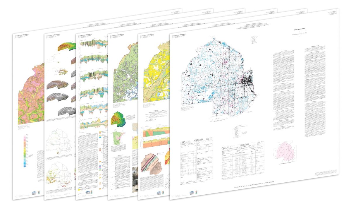
Atlases begin with a database compilation of subsurface information. The most abundant data source is the construction records of water wells, or County Well Index. With the cooperation of the County, accurate digital locations are established for these wells to support their use in mapping.
Concurrently, geologists visit the project area to describe and sample landforms and exposures of rock or sediment. An initial assessment of the geologic data is then completed to focus additional data gathering including shallow and deep drilling programs.
Analysis of the complete data set is then completed, and maps and associated databases are prepared for use in geographic information systems (GIS) and distributed online. Most of the products are also printed for the benefit of users who prefer this format. GIS files are available for atlases beginning with C-7. Scott County has been revised, so the original C-1 maps are available as scans, while the C-17 revision is available with GIS files.
CGA Map & Data Library
Part A: Geologic Atlases (MGS)
All published County Geologic Atlas Part A maps & data are archived through our Map & Data Library on the University's Digital Conservancy website. You can search and browse for specific CGAs through the Map & Data Library or quickly find specific County Atlas data through our interactive status web map or county drop-down menus below.
CGA Part A Geology Map & Data Library
Part B: Groundwater Atlases (DNR)
All published Part B maps & data are hosted and available to download on the Minnesota Department of Natural Resources CGA website.
CGA Part B Groundwater/Hydrogeology Map & Data Library
Print-On-Demand
The MGS has partnered with OceanGrafix to provide print-on-demand County Geologic Atlases. Use the link provided below to browse and purchase available print-on-demand Atlases.
Find/Download CGA Maps and Data by County
+
Aitkin
Aitkin County Atlas, C-52
Part A - Geology (MGS)
- View/Download Publication
- View Online Story Map
- Publication Date: 2022
- Project Manager: Emily J. Bauer
- Included in publication:
- Plate 1, Database Map - Emily J. Bauer and V.W. Chandler (PDF)
- Plate 2, Bedrock Geology Map - Terrence J. Boerboom and V.W. Chandler (PDF)
- Plate 3, Surficial Geology Map - Alan R. Knaeble and Maurice K. Nguyen (PDF)
- Plate 4, Quaternary Stratigraphy - Alan R. Knaeble and Maurice K. Nguyen (PDF)
- Plate 5, Sand Distribution Model - Alan R. Knaeble, Maurice K. Nguyen, and R.S. Lively (PDF)
- Plate 6, Bedrock Topography and Depth to Bedrock Maps - Dale R. Setterholm and Julia R. Steenberg (PDF)
- Supplemental data and GIS files (ZIP)
Part B - Groundwater/Hydrogeology (DNR)
- In progress
+
Anoka
Anoka County Atlas, C-27
Part A - Geology (MGS)
- View/Download Publication
- View Online Story Map
- Publication Date: 2013
- Project Manager: Dale R. Setterholm
- Included in publication:
- Plate 1, Database Map - Emily J. Bauer (PDF)
- Plate 2, Bedrock Geology Map - John H. Mossler (PDF)
- Plate 3, Surficial Geology Map - Gary N. Meyer (PDF)
- Plate 4, Quaternary Stratigraphy - Gary N. Meyer (PDF)
- Plate 5, Sand Distribution Model - Gary N. Meyer, Robert G. Tipping, and R.S. Lively (PDF)
- Plate 6, Bedrock Topography and Depth to Bedrock Maps - John. H. Mossler (PDF)
- Supplemental data and GIS files (ZIP)
- Description of files (TXT)
- Raster datasets of bedrock units; added in 2016 (ZIP)
Part B - Groundwater/Hydrogeology (DNR)
- View/Download Publication
- Publication Date: 2016
- Included in publication:
- Report - James A. Berg (PDF)
- Plate 7, Water Chemistry - James A. Berg (PDF)
- Plate 8, Hydrogeologic Cross Sections (A-A' through E-E') - James A. Berg (PDF)
- Plate 9, Hydrogeologic Cross Sections (F-F' through I-I') - James A. Berg (PDF)
- GIS files (ZIP)
+
Becker
Becker County Atlas, C-42
Part A - Geology (MGS)
- View/Download Publication
- View Online Story Map
- Publication Date: 2016
- Project Manager: Emily J. Bauer
- Included in publication:
- Plate 1, Database Map - Emily J. Bauer and V.W. Chandler (PDF)
- Plate 2, Bedrock Geology Map - Mark A. Jirsa and V.W. Chandler (PDF)
- Plate 3, Surficial Geology Map - Katherine J. Marshall and Angela S. Gowan (PDF)
- Plate 4, Quaternary Stratigraphy - Angela S. Gowan and Katherine J. Marshall (PDF)
- Plate 5, Supplemental Quaternary Stratigraphy and Sand Distribution Model - Angela S. Gowan and Katherine J. Marshall (PDF)
- Plate 6, Bedrock Topography and Depth to Bedrock Maps - Amy L. Radakovich and V.W. Chandler (PDF)
- Supplemental data and GIS files, 1 of 2 (2016 archive) (ZIP)
- Supplemental data and GIS files: Sand and till rasters, 2 of 2 (2016 archive) (ZIP)
- Description of geophysical products (PDF)
- Geophysical data and models (ZIP)
- Supplemental data and GIS files (January 2020 update) (ZIP)
Part B - Groundwater/Hydrogeology (DNR)
- View/Download Publication
- Publication Date: 2023
- Included in publication:
- Report - Randy J. Bradt (PDF)
- Plate 7, Water Chemistry - Randy J. Bradt (PDF)
- Plate 8, Hydrogeologic Cross Sections (A-A' through D-D') - Randy J. Bradt (PDF)
- Plate 9, Hydrogeologic Cross Sections (E-E' through H-H') - Randy J. Bradt (PDF)
- GIS files (ZIP)
+
Beltrami (IN PROGRESS)
Beltrami County Atlas
Part A - Geology (MGS)
- Publication Date: TBD
- Project Manager: Aaron C. Hirsch
Part B - Groundwater/Hydrogeology (DNR)
- Future start
+
Benton
Benton County Atlas, C-23
Part A - Geology (MGS)
- View/Download Publication
- Publication Date: 2010
- Project Manager: Dale R. Setterholm
- Included in publication:
- Plate 1, Database Map - Emily J. Bauer (PDF)
- Plate 2, Bedrock Geology Map - Mark A. Jirsa and V.W. Chandler (PDF)
- Plate 3, Surficial Geology Map - Gary N. Meyer (PDF)
- Plate 4, Quaternary Stratigraphy - Gary N. Meyer and Angela S. Gowan (PDF)
- Plate 5, Bedrock Topography, Depth to Bedrock and Sand Distribution Model - Dale R. Setterholm, Gary N. Meyer, R.S. Lively, and Angela S. Gowan (PDF)
- Supplemental data and GIS files (ZIP)
- Description of files (TXT)
Part B - Groundwater/Hydrogeology (DNR)
- View/Download Publication
- Publication Date: 2012
- Included in publication:
- Plate 6, Hydrogeology of the Surficial Sand Aquifer - Jeremy S. Rivord (PDF)
- Plate 7, Hydrogeologic Cross Sections - Jeremy S. Rivord (PDF)
- Plate 8, Hydrogeology of the Buried Aquifers and the Rice Area Aquifer System - Jeremy S. Rivord (PDF)
- Plate 9, Sensitivity of Groundwater Systems to Pollution - Jeremy S. Rivord (PDF)
- GIS files (ZIP)
+
Big Stone (CURRENTLY NO ATLAS)
+
Blue Earth
Blue Earth County Atlas, C-26
Part A - Geology (MGS)
- View/Download Publication
- Publication Date: 2012
- Project Manager: Anthony C. Runkel
- Included in publication:
- Plate 1, Database Map - Emily J. Bauer (PDF)
- Plate 2, Bedrock Geology Map - Julia R. Steenberg (PDF)
- Plate 3, Surficial Geology Map - Carrie E. Jennings, Barbara A. Lusardi, and Angela S. Gowan (PDF)
- Plate 4, Quaternary Stratigraphy - Gary N. Meyer, Alan R. Knaeble, Barbara A. Lusardi, Carrie E. Jennings, and Angela S. Gowan (PDF)
- Plate 5, Sand Distribution Model - Gary N. Meyer and R.S. Lively (PDF)
- Plate 6, Bedrock Topography and Depth to Bedrock Maps - Julia R. Steenberg (PDF)
- Supplemental data and GIS files (ZIP)
- Description of files (TXT)
Part B - Groundwater/Hydrogeology (DNR)
- View/Download Publication
- Publication Date: 2016
- Included in publication:
- Report - James A. Berg (PDF)
- Plate 7, Uppermost Bedrock Groundwater Flow Directions and Bedrock Geology - James A. Berg (PDF)
- Plate 8, Hydrogeologic Cross Sections (A-A' through D-D') - James A. Berg (PDF)
- Plate 9, Hydrogeologic Cross Sections (E-E' through H-H') - James A. Berg (PDF)
- GIS files (ZIP)
+
Brown
Brown County Atlas, C-37
Part A - Geology (MGS)
- View/Download Publication
- Publication Date: 2016
- Project Manager: Terrence J. Boerboom
- Included in publication:
- Plate 1, Database Map - Emily J. Bauer and V.W. Chandler (PDF)
- Plate 2, Bedrock Geology Map - Terrence J. Boerboom and Julia R. Steenberg (PDF)
- Plate 3, Surficial Geology Map - Howard C. Hobbs and Alan R. Knaeble (PDF)
- Plate 4, Quaternary Stratigraphy - Alan R. Knaeble (PDF)
- Plate 5, Bedrock Topography, Depth to Bedrock and Sand Distribution Model - Julia R. Steenberg, Alan R. Knaeble and R.S. Lively (PDF)
- Plate 5 Maps at 1:100,000-scale (ZIP)
- Supplemental data and GIS files (March 2019 update) (ZIP)
Part B - Groundwater/Hydrogeology (DNR)
- View/Download Publication
- Publication Date: 2020
- Included in publication:
- Report - James A. Berg, Randy J. Bradt, and J. Wes Rutelonis (PDF)
- Plate 6, Water Chemistry - Randy J. Bradt (PDF)
- Plate 7, Hydrogeologic Cross Sections - James A. Berg and J. Wes Rutelonis (PDF)
- GIS files (ZIP)
+
Carlton
Carlton County Atlas, C-19
Part A - Geology (MGS)
- View/Download Publication
- View Online Story Map
- Publication Date: 2009
- Project Manager: Terrence J. Boerboom
- Included in publication:
- Plate 1, Database Map - Emily J. Bauer (PDF)
- Plate 2, Bedrock Geology Map - Terrence J. Boerboom (PDF)
- Plate 3, Surficial Geology Map - Alan R. Knaeble and Howard C. Hobbs (PDF)
- Plate 4, Quaternary Stratigraphy - Alan R. Knaeble and Howard C. Hobbs (PDF)
- Plate 5, Bedrock Topography, Depth to Bedrock and Sand Distribution Model - Dale R. Setterholm, Alan R. Knaeble and R.S. Lively (PDF)
- Plate 6, Mineral Endowment - Terrence J. Boerboom (PDF)
- Supplemental data and GIS files (ZIP)
- Supplementary digital file of Water Well data within the study area that has a more complete attribute table. No new wells were added. (ZIP)
- Read Me - Description of Files (TXT)
Part B - Groundwater/Hydrogeology (DNR)
- View/Download Publication
- Publication Date: 2011
- Included in publication:
- Plate 7, Hydrogeology of the Surficial Aquifer - James A. Berg (PDF)
- Plate 8, Hydrogeologic Cross Sections - James A. Berg (PDF)
- Plate 9, Hydrogeology of the Buried Aquifers - James A. Berg (PDF)
- Plate 10, Sensitivity of Groundwater Systems to Pollution - James A. Berg (PDF)
- GIS files (ZIP)
+
Carver
Carver County Atlas, C-21
Part A - Geology (MGS)
- View/Download Publication
- Publication Date: 2009
- Project Manager: Emily J. Bauer
- Included in publication:
- Plate 1, Database Map - Emily J. Bauer (PDF)
- Plate 2, Bedrock Geology Map - John H. Mossler and V.W. Chandler (PDF)
- Plate 3, Surficial Geology Map - Barbara A. Lusardi (PDF)
- Plate 4, Quaternary Stratigraphy and Sand Distribution Model - Barbara A. Lusardi and Robert G. Tipping (PDF)
- Plate 5, Bedrock Topography and Depth to Bedrock Maps - John H. Mossler and R.S. Lively (PDF)
- Supplemental data and GIS files (ZIP)
- Read Me - Description of Files (TXT)
Part B - Groundwater/Hydrogeology (DNR)
- View/Download Publication
- Publication Date: 2014
- Included in publication:
- Plate 6, Quaternary Hydrogeology - Todd A. Petersen (PDF)
- Plate 6, Quaternary Hydrogeology with LiDAR (PDF)
- Plate 7, Hydrogeologic Cross Sections - Todd A. Petersen (PDF)
- Plate 8, Bedrock Hydrogeology - Todd A. Petersen (PDF)
- Plate 9, Pollution Sensitivity - Todd A. Petersen (PDF)
- GIS files (ZIP)
- Plate 6, Quaternary Hydrogeology - Todd A. Petersen (PDF)
+
Cass
Cass County Atlas, C-43
Part A - Geology (MGS)
- View/Download Publication
- View Online Story Map
- Publication Date: 2018
- Project Manager: Barbara A. Lusardi
- Included in publication:
- Plate 1, Database Map - Margeurite C. Pettus and V.W. Chandler (PDF)
- Plate 2, Bedrock Geology Map - Amy L. Radakovich and V.W. Chandler (PDF)
- Plate 3, Surficial Geology Map - Barbara A. Lusardi and Maurice K. Nguyen (PDF)
- Plate 4, Quaternary Stratigraphy - Barbara A. Lusardi, Maurice K. Nguyen, and Amie E. Staley (PDF)
- Plate 5, Sand Distribution Model - Barbara A. Lusardi, Maurice K. Nguyen, Amie E. Staley, and Jacqueline D. Hamilton (PDF)
- Plate 6, Bedrock Topography and Depth to Bedrock Maps - Amy L. Radakovich and V.W. Chandler (PDF)
- Supplemental data and GIS files (ZIP)
- Full set of sand and till grids (ZIP)
- Description of geophysical products (PDF)
- Geophysical data and models (ZIP)
- Revisions to sand model data, 2022 (ZIP)
Part B - Groundwater/Hydrogeology (DNR)
- View/Download Publication
- Publication Date: 2023
- Included in publication:
- Report - James A. Berg and Rachel E. Lindgren (PDF)
- Plate 7, Water Chemistry - Rachel E. Lindgren (PDF)
- Plate 8, Hydrogeologic Cross Sections - James A. Berg and Rachel E. Lindgren (PDF)
- GIS files (ZIP)
+
Chippewa (IN PROGRESS)
Chippewa County Atlas
Part A - Geology (MGS)
- Publication Date: TBD
- Project Manager: Amy R. Block
Part B - Groundwater/Hydrogeology (DNR)
- Future start
+
Chisago
Chisago County Atlas, C-22
Part A - Geology (MGS)
- View/Download Publication
- Publication Date: 2010
- Project Manager: Dale R. Setterholm
- Included in publication:
- Plate 1, Database Map - Emily J. Bauer (PDF)
- Plate 2, Bedrock Geology Map - Anthony C. Runkel and Terrence J. Boerboom (PDF)
- Plate 3, Surficial Geology Map - Gary N. Meyer (PDF)
- Plate 4, Quaternary Stratigraphy - Gary N. Meyer (PDF)
- Plate 5, Sand Distribution Model and Precambrian Bedrock Geology Map - Gary N. Meyer and R.S. Lively; Terrence J. Boerboom (PDF)
- Plate 6, Bedrock Topography and Depth to Bedrock Maps - Anthony C. Runkel (PDF)
- Supplemental data and GIS files (ZIP)
- Explanation (TXT)
Part B - Groundwater/Hydrogeology (DNR)
- View/Download Publication
- Publication Date: 2014
- Included in publication:
- Plate 7, Surficial Aquifer Hydrogeology - John D. Barry (PDF)
- Plate 7, Figure 1, Water-Table Elevation with LiDAR (PDF)
- Plate 8, Quaternary and Bedrock Aquifer Hydrogeology - John D. Barry (PDF)
- Plate 9, Hydrogeologic Cross Sections - John D. Barry (PDF)
- Plate 9, Cross Section Supplement (PDF)
- Plate 10, Pollution Sensitivity - John D. Barry (PDF)
- GIS files (ZIP)
- Plate 7, Surficial Aquifer Hydrogeology - John D. Barry (PDF)
+
Clay
Clay County Atlas, C-29
Part A - Geology (MGS)
- View/Download Publication
- Publication Date: 2014
- Project Manager: Emily J. Bauer
- Included in publication:
- Plate 1, Database Map - Emily J. Bauer (PDF)
- Plate 2, Bedrock Geology Map - V.W. Chandler, Mark A. Jirsa, and Dale R. Setterholm (PDF)
- Plate 3, Surficial Geology Map - Howard C. Hobbs and Angela S. Gowan (PDF)
- Plate 4, Quaternary Stratigraphy - Angela S. Gowan (PDF)
- Plate 5, Bedrock Topography and Depth to Bedrock Maps and Sand Distribution Model - Dale R. Setterholm; Angela S. Gowan (PDF)
- Supplemental data and GIS files (ZIP)
- Explanation (TXT)
Part B - Groundwater/Hydrogeology (DNR)
- View/Download Publication
- Publication Date: 2018
- Included in publication:
- Report - James A. Berg (PDF)
- Plate 6, Water Chemistry - James A. Berg (PDF)
- Plate 7, Hydrogeologic Cross Sections - James A. Berg and Meagan E. Harold (PDF)
- Plate 8, Hydrogeologic Cross Sections (cont.) - James A. Berg and Meagan E. Harold (PDF)
- GIS files (ZIP)
+
Clearwater (IN PROGRESS)
Clearwater County Atlas
Part A - Geology (MGS)
- Publication Date: TBD
- Project Manager: Amy L. Radakovich
Part B - Groundwater/Hydrogeology (DNR)
- Future start
+
Cook
Cook County Atlas, C-56
Part A - Geology (MGS)
- View/Download Publication
- Publication Date: 2026
- Project Manager: Allison R. Severson
- Included in publication:
- Plate 1, Database Map - Jordan A. Mayer (PDF)
- Plate 2, Bedrock Geology Map - Allison R. Severson, Eric S. Nowariak, Terrence J. Boerboom, and Amy L. Radakovich (MGS); Mark J. Severson and James D. Miller, Jr. (UMD) (PDF)
- Plate 2, Appendix A (PDF)
- Plate 2, Appendix B (PDF)
- Plate 2, Appendix C (PDF)
- Plate 3, Surficial Geology Map - Kaleb G. Wagner (PDF)
- Plate 3, Appendix A (PDF)
- Plate 3, Appendix B (PDF)
- Plate 4, Bedrock Topography and Depth to Bedrock Maps - Amy L. Radakovich, Jacqueline D. Hamilton, and Aaron C. Hirsch (PDF)
- Digital and GIS data (ZIP)
Part B - Groundwater/Hydrogeology (DNR)
- Future start
+
Cottonwood (IN PROGRESS)
Cottonwood County Atlas
Part A - Geology (MGS)
- Publication Date: TBD
- Project Manager: Jordan Van Berkel
Part B - Groundwater/Hydrogeology (DNR)
- Future start
+
Crow Wing
Crow Wing County Atlas, C-16
Part A - Geology (MGS)
- View/Download Publication
- Publication Date: 2004
- Project Manager: Dale R. Setterholm
- Included in publication:
- Plate 1, Database Map - Emily J. Bauer (PDF)
- Plate 2, Bedrock Geology Map - Terrence J. Boerboom and V.W. Chandler (PDF)
- Plate 3, Surficial Geology Map - Alan R. Knaeble, Gary N. Meyer, and Howard C. Hobbs (PDF)
- Plate 4, Quaternary Stratigraphy - Alan R. Knaeble and Gary N. Meyer (PDF)
- Plate 5, Bedrock Topography and Depth to Bedrock Maps and Quaternary Subsurface Geology Map - Dale R. Setterholm; Gary N. Meyer (PDF)
- Plate 6, Mineral Endowment Map - Gary N. Meyer and Terrence J. Boerboom (PDF)
- Supplementary files (ZIP)
- GIS files (ZIP)
- Readme (TXT)
Part B - Groundwater/Hydrogeology (DNR)
- View/Download Publication
- Publication Date: 2007
- Included in publication:
- Plate 7, Hydrogeology of the Buried and Surficial Aquifers - Todd A. Petersen (PDF)
- Plate 8, Hydrogeologic Cross Sections - Todd A. Petersen (PDF)
- Plate 9, Pollution Sensitivity of the Buried and Surficial Aquifers - Todd A. Petersen (PDF)
- Plate 10, Interaction of Lakes and Ground Water - Todd A. Petersen and James A. Solstad (PDF)
- GIS files (ZIP)
+
Dakota
Dakota County Atlas, C-57 (2023 Revision)
Part A - Geology (MGS)
- View/Download Publication
- View Online Story Map
- Publication Date: 2023
- Project Manager: Julia R. Steenberg
- Included in publication:
- Plate 1, Database Map - Emily J. Bauer (PDF)
- Plate 2, Bedrock Geology Map - Julia R. Steenberg (PDF)
- Plate 3, Surficial Geology Map - Angela S. Gowan and Amie E. Staley (PDF)
- Plate 4, Quaternary Stratigraphy - Angela S. Gowan (PDF)
- Plate 5, Sand Distribution Model - Angela S. Gowan and Sarah W. Francis (PDF)
- Plate 6, Bedrock Topography and Depth to Bedrock Maps - Julia R. Steenberg and V.W. Chandler (PDF)
- Digital and GIS data (ZIP)
- Supplemental bedrock surface rasters (ZIP)
Part B - Groundwater/Hydrogeology (DNR)
- In progress
Dakota County Atlas, C-06 (1990 Archived Version)
Part A & B - Geology & GROUNDWATER/HYDROGEOLOGY (MGS & MDH)
- View/Download Publication
- Publication Date: 1990
- Project Manager: N.H. Balaban and H.C. Hobbs
- Included in publication:
- Plate 1, Database Map - Jane M. Cleland, Timothy E. Wahl, Bruce A. Bloomgren, and Howard C. Hobbs (PDF)
- Plate 2, Bedrock Geology Map - John H. Mossler (PDF)
- Plate 3, Surficial Geology Map - Howard C. Hobbs, Saul Aronow, and Carrie J. Patterson (PDF)
- Plate 4, Depth to Bedrock and Bedrock Topography Maps - Bruce A. Bloomgren, Howard C. Hobbs, John H. Mossler, and Carrie J. Patterson (PDF)
- Plate 5, Quaternary Hydrogeology Map - Barbara M. Palen (PDF)
- Plate 6, Bedrock Hydrogeology Map - Barbara M. Palen (PDF)
- Plate 7, Sensitivity of the Prairie du Chien-Jordan Aquifer to Pollution Map - Howard C. Hobbs (PDF)
- Plate 8, Geology and Well Construction Map - James F. Walsh and Bruce M. Olsen (PDF)
- Plate 9, Geologic Resources Map - John H. Mossler (PDF)
- Supplementary Files (ZIP)
- Readme (TXT)
+
Dodge
Dodge County Atlas, C-50
Part A - Geology (MGS)
- View/Download Publication
- View Online Story Map
- Publication Date: 2019
- Project Manager: Julia R. Steenberg
- Included in publication:
- Plate 1, Database Map - Emily J. Bauer and V.W. Chandler (PDF)
- Plate 2, Bedrock Geology Map - Andrew J. Retzler (PDF)
- Plate 3, Surficial Geology Map - Katherine J. Marshall and Jennifer M. McDonald (PDF)
- Plate 4, Quaternary Stratigraphy - Gary N. Meyer, Katherine J. Marshall, and Jennifer M. McDonald (PDF)
- Plate 5, Sand Distribution Model - Gary N. Meyer, R.S. Lively, and Andrew J. Retzler (PDF)
- Plate 6, Bedrock Topography and Depth to Bedrock Maps - Andrew J. Retzler (PDF)
- Supplemental digital and GIS data (ZIP)
Part B - Groundwater/Hydrogeology (DNR)
- View/Download Publication
- Publication Date: 2024
- Included in publication:
- Report - Randy J. Bradt and John D. Barry (PDF)
- Plate 7, Water Chemistry - Randy J. Bradt (PDF)
- Plate 8, Hydrogeologic Cross Sections (A-A' through E-E') - Randy J. Bradt (PDF)
- Plate 9, Hydrogeologic Cross Sections (F-F' through J-J') - Randy J. Bradt (PDF)
- GIS files (ZIP)
+
Douglas (IN PROGRESS)
Douglas County Atlas
Part A - Geology (MGS)
- Publication Date: TBD
- Project Manager: Dan Conrad
Part B - Groundwater/Hydrogeology (DNR)
- Future start
+
Faribault (IN PROGRESS)
Faribault County Atlas
Part A - Geology (MGS)
- Publication Date: TBD
- Project Manager: Jordan Mayer
Part B - Groundwater/Hydrogeology (DNR)
- Future start
+
Fillmore
Fillmore County Atlas, C-08
Part A - Geology (MGS)
- View/Download Publication
- Publication Date: 1995
- Project Manager: John H. Mossler
- Included in publication:
- Plate 1, Database Map - Jane M. Cleland and Robert G. Tipping (PDF)
- Plate 2, Bedrock Geology Map - John H. Mossler (PDF)
- Plate 3, Surficial Geology Map - Howard C. Hobbs (PDF)
- Plate 4, Depth to Bedrock and Bedrock Topography Maps - John H. Mossler and Howard C. Hobbs (PDF)
- Plate 5, Geologic Resources - Anthony C. Runkel (PDF)
- C-8 Text Supplement [Part C] - R.S. Lively and N.H. Balaban, Editors (PDF)
- Supplementary files (ZIP)
- GIS files (ZIP)
- Index (TXT)
Part B - Groundwater/Hydrogeology (DNR)
- View/Download Publication
- Publication Date: 1996
- Included in publication:
- Plate 6, Bedrock Hydrogeology - Hua Zhang and Roman Kanivetsky (PDF)
- Plate 7, Sensitivity of the St. Peter-Prairie du Chien-Jordan Aquifer to Pollution - Hua Zhang and Jan Falteisek (PDF)
- Plate 8, Sinkholes and Sinkhole Probability - Kathleen M. Witthuhn and E. Calvin Alexander, Jr. (PDF)
- Plate 9, Springsheds - E. Calvin Alexander, Jr., Jeffrey A. Green, Scott C. Alexander, and Ronald C. Spong (PDF)
- GIS files (ZIP)
+
Freeborn (IN PROGRESS)
Freeborn County Atlas
Part A - Geology (MGS)
- Publication Date: TBD
- Project Manager: Andrew J. Retzler
Part B - Groundwater/Hydrogeology (DNR)
- Future start
+
Goodhue
Goodhue County Atlas, C-12
Part A - Geology (MGS)
- View/Download Publication
- Publication Date: 1998
- Project Manager: Dale R. Setterholm
- Included in publication:
- Plate 1, Database Map - Emily J. Bauer (PDF)
- Plate 2, Bedrock Geology Map - Anthony C. Runkel (PDF)
- Plate 3, Surficial Geology and Thickness of Quaternary Sediments Map - Howard C. Hobbs and Dale R. Setterholm (PDF)
- Plate 4, Quaternary Stratigraphy - Howard C. Hobbs (PDF)
- Plate 5, Bedrock Topography Map - Dale R. Setterholm and Bruce A. Bloomgren (PDF)
- Plate 6, Geologic Resources Map - Dale R. Setterholm and Howard C. Hobbs (PDF)
- Supplementary files (ZIP)
- GIS files (ZIP)
- Readme (TXT)
Part B - Groundwater/Hydrogeology (DNR)
- View/Download Publication
- Publication Date: 2003
- Included in publication:
- Plate 7, Bedrock and Water-Table Hydrogeology - James A. Berg and Randy Bradt (PDF)
- Plate 7, Figure, Water Table Depth Model (PDF)
- Plate 8, Hydrogeologic Cross Sections - James A. Berg (PDF)
- Plate 9, Sensitivity to Pollution of the Uppermost Bedrock Aquifers - James A. Berg (PDF)
- Plate 9 errata (PDF)
- Plate 10, Sinkholes, Sinkhole Probability, and Springs and Seeps - E. Calvin Alexander, Jr., David J. Berner, Yongli Gao, and Jeffrey A. Green (PDF)
- GIS files (ZIP)
- Plate 7, Bedrock and Water-Table Hydrogeology - James A. Berg and Randy Bradt (PDF)
+
Grant (IN PROGRESS)
Grant County Atlas
Part A - Geology (MGS)
- Publication Date: TBD
- Project Manager: Dan Conrad
Part B - Groundwater/Hydrogeology (DNR)
- Future start
+
Hennepin
Hennepin County Atlas, C-45 (2018 Revision)
Part A - Geology (MGS)
- View/Download Publication
- View Online Story Map
- Publication Date: 2018
- Project Manager: Julia R. Steenberg
- Included in publication:
- Plate 1, Database Map - Emily J. Bauer and V.W. Chandler (PDF)
- Plate 2, Bedrock Geology Map - Andrew J. Retzler (PDF)
- Plate 3, Surficial Geology Map - Angela J. Berthold (PDF)
- Plate 4, Quaternary Stratigraphy - Angela J. Berthold (PDF)
- Plate 5, Sand Distribution Model - Angela J. Berthold and Richard S. Lively (PDF)
- Plate 6, Bedrock Topography and Depth to Bedrock Maps - Andrew J. Retzler (PDF)
- Supplemental digital and GIS data (ZIP)
- Description of the Atlas files (PDF)
- Updated bedrock surfaces and CGA User's Guide (ZIP)
Part B - Groundwater/Hydrogeology (DNR)
- View/Download Publication
- Publication Date: 2021
- Included in publication:
- Report - James A. Berg (PDF)
- Plate 7, Water Chemistry - James A. Berg (PDF)
- Plate 8, Hydrogeologic Cross Sections, A-A' through G-G' - James A. Berg (PDF)
- Plate 9, Hydrogeologic Cross Sections, H-H' through L-L' - James A. Berg (PDF)
- GIS files (ZIP)
Hennepin County Atlas, C-04 (1989 Archived Version)
Part A & B - Geology & Groundwater/Hydrogeology (MGS)
- View/Download Publication
- Publication Date: 1989
- Project Manager: N.H. Balaban
- Included in publication:
- Plate 1, Database Map - Bruce A. Bloomgren, Robert G. Tipping, and Timothy E. Wahl (PDF)
- Plate 2, Bedrock Geology Map - Bruce M. Olsen and Bruce A. Bloomgren (PDF)
- Plate 3, Surficial Geology Map - Gary N. Meyer and Howard C. Hobbs (PDF)
- Plate 4, Depth to Bedrock and Bedrock Topography Maps - Bruce A. Bloomgren, Jane M. Cleland, and Bruce M. Olsen (PDF)
- Plate 5, Quaternary Hydrogeology Map - Roman Kanivetsky (PDF)
- Plate 6, Bedrock Hydrogeology Map - Roman Kanivetsky (PDF)
- Plate 7, Sensitivity of Ground-Water Systems to Pollution Map - James Piegat (PDF)
- Plate 8, Geology and Well Construction - Bruce M. Olsen and Bruce A. Bloomgren (PDF)
- Plate 9, Geologic Resources Map - John H. Mossler (PDF)
- Supplemental digital and GIS data (ZIP)
- Readme (TXT)
+
Houston
Houston County Atlas, C-33
Part A - Geology (MGS)
- View/Download Publication
- Publication Date: 2014
- Project Manager: Dale R. Setterholm
- Included in publication:
- Plate 1, Database Map - Emily J. Bauer and V.W. Chandler (PDF)
- Plate 2, Bedrock Geology Map - Julia R. Steenberg (PDF)
- Plate 3, Surficial Geology Map - Barbara A. Lusardi, Roberta S. Adams, and Howard C. Hobbs (PDF)
- Plate 4, Bedrock Topography and Depth to Bedrock Maps - Julia R. Steenberg (PDF)
- Supplemental digital and GIS data (ZIP)
Part B - Groundwater/Hydrogeology (DNR)
- View/Download Publication
- Publication Date: 2025
- Included in publication:
- Report - John D. Barry (PDF)
- Plate 5, Water Chemistry - John D. Barry (PDF)
- Plate 6, Hydrogeologic Cross Sections, A-A' through F-F' - John D. Barry (PDF)
- GIS files (ZIP)
+
Hubbard
Hubbard County Atlas, C-41
Part A - Geology (MGS)
- View/Download Publication
- View Online Story Map
- Publication Date: 2018
- Project Manager: Barbara A. Lusardi
- Included in publication:
- Plate 1, Database Map - Bruce A. Bloomgren and V.W. Chandler (PDF)
- Plate 2, Bedrock Geology Map - V.W. Chandler and Amy L. Radakovich (PDF)
- Plate 3, Surficial Geology Map - Alan R. Knaeble and Devin D. Hougardy (PDF)
- Plate 4, Quaternary Stratigraphy - Alan R. Knaeble (PDF)
- Plate 5, Sand Distribution Model - Alan R. Knaeble and Jacqueline D. Hamilton (PDF)
- Plate 6, Bedrock Topography and Depth to Bedrock Maps - Amy L. Radakovich and V.W. Chandler (PDF)
- Supplemental digital and GIS data - updated March 2019 (ZIP)
- Description of the Atlas files (PDF)
- Description of geophysical products (PDF)
- Geophysical data and models (ZIP)
Part B - Groundwater/Hydrogeology (DNR)
- View/Download Publication
- Publication Date: 2024
- Included in publication:
- Report - Nicholas R. Budde (PDF)
- Plate 7, Water Chemistry - Nicholas R. Budde (PDF)
- Plate 8, Hydrogeologic Cross Sections (A-A' through D-D') - Nicholas R. Budde (PDF)
- Plate 9, Hydrogeologic Cross Sections (E-E' through H-H') - Nicholas R. Budde (PDF)
- GIS files (ZIP)
+
Isanti
Isanti County Atlas, C-44
Part A - Geology (MGS)
- View/Download Publication
- View Online Story Map
- Publication Date: 2017
- Project Manager: V.W. Chandler
- Included in publication:
- Plate 1, Database Map - Margeurite C. Pettus and V.W. Chandler (PDF)
- Plate 2, Bedrock Geology Map - Anthony C. Runkel (PDF)
- Plate 3, Surficial Geology Map - Devin D. Hougardy and Gary N. Meyer (PDF)
- Plate 4, Quaternary Stratigraphy - Gary N. Meyer (PDF)
- Plate 5, Sand Distribution Model - Gary N. Meyer and Jacqueline D. Hamilton (PDF)
- Plate 6, Bedrock Topography and Depth to Bedrock Maps - Anthony C. Runkel (PDF)
- Supplemental digital and GIS data (ZIP)
- Final bedrock grids for Part A (ZIP)
- Revisions to sand model data 2022 (ZIP)
Part B - Groundwater/Hydrogeology (DNR)
- View/Download Publication
- Publication Date: 2025
- Included in publication:
- Report - Vanessa M. Baratta-Person, James A. Berg, and J. Wes Rutelonis (PDF)
- Plate 7, Water Chemistry - Vanessa M. Baratta-Person, James A. Berg, and J. Wes Rutelonis (PDF)
- Plate 8, Hydrogeologic Cross Sections (A-A' through H-H') - Vanessa M. Baratta-Person, James A. Berg, and J. Wes Rutelonis (PDF)
- GIS files (ZIP)
+
Itasca (IN PROGRESS)
Itasca County Atlas
Part A - Geology (MGS)
- Publication Date: TBD
- Project Manager: Allison R. Severson
Part B - Groundwater/Hydrogeology (DNR)
- Future start
+
Jackson (IN PROGRESS)
Jackson County Atlas
Part A - Geology (MGS)
- Publication Date: TBD
- Project Manager: TBD
Part B - Groundwater/Hydrogeology (DNR)
- Future start
+
Kanabec
Kanabec County Atlas, C-38
Part A - Geology (MGS)
- View/Download Publication
- View Online Story Map
- Publication Date: 2016
- Project Manager: Terrence J. Boerboom
- Included in publication:
- Plate 1, Database Map - Bruce A. Bloomgren and V.W. Chandler (PDF)
- Plate 2, Bedrock Geology Map - Terrence J. Boerboom, V.W. Chandler, and Anthony C. Runkel (PDF)
- Plate 3, Surficial Geology Map - Elizabeth L. Dengler (PDF)
- Plate 4, Quaternary Stratigraphy - Elizabeth L. Dengler (PDF)
- Plate 5, Bedrock Topography and Depth to Bedrock Maps and Sand Distribution Model - Dale R. Setterholm; Elizabeth L. Dengler and Jacqueline D. Hamilton (PDF)
- Supplemental digital and GIS data (ZIP)
Part B - Groundwater/Hydrogeology (DNR)
- View/Download Publication
- Publication Date: 2020
- Included in publication:
- Report - James A. Berg (PDF)
- Plate 6, Water Chemistry - John D. Barry and Rachel E. Lindgren (PDF)
- Plate 7, Hydrogeologic Cross Sections - James A. Berg and Rachel E. Lindgren (PDF)
- GIS files (ZIP)
+
Kandiyohi
Kandiyohi County Atlas, C-46
Part A - Geology (MGS)
- View/Download Publication
- View Online Story Map
- Publication Date: 2019
- Project Manager: Jacqueline D. Hamilton
- Included in publication:
- Plate 1, Database Map - Emily J. Bauer and V.W. Chandler (PDF)
- Plate 2, Bedrock Geology Map - V.W. Chandler and Julia R. Steenberg (PDF)
- Plate 3, Surficial Geology Map - Amie E. Staley (PDF)
- Plate 4, Quaternary Stratigraphy - Amie E. Staley (PDF)
- Plate 5, Sand Distribution Model - Amie E. Staley and Jacqueline D. Hamilton (PDF)
- Plate 6, Bedrock Topography and Depth to Bedrock Maps - Julia R. Steenberg and V.W. Chandler (PDF)
- Supplemental digital and GIS data (ZIP)
- Updated Surficial Geology (GIS shapefile) (ZIP)
- Revisions to sand model data 2022 (ZIP)
Part B - Groundwater/Hydrogeology (DNR)
- In progress
+
Kittson (CURRENTLY NO ATLAS)
+
Koochiching (IN PROGRESS)
Koochiching County Atlas
Part A - Geology (MGS)
- Publication Date: TBD
- Project Manager: Eric Nowariak
Part B - Groundwater/Hydrogeology (DNR)
- Future start
+
Lac qui Parle
Lac qui Parle County Atlas, C-65
Part A - Geology (MGS)
- View/Download Publication
- View Online Story Map
- Publication Date: 2023
- Project Manager: Emily J. Bauer
- Included in publication:
- Plate 1, Database Map - Emily J. Bauer and Aaron C. Hirsch (PDF)
- Plate 2, Bedrock Geology Map - Julia R. Steenberg, Allison R. Severson, Terrence J. Boerboom, and Aaron C. Hirsch (PDF)
- Plate 3, Surficial Geology Map - Angela J. Radke (PDF)
- Plate 4, Quaternary Stratigraphy - Angela J. Radke (PDF)
- Plate 5, Sand Distribution Model - Angela J. Radke and R.S. Lively (PDF)
- Plate 6, Bedrock Topography and Depth to Bedrock Maps - Julia R. Steenberg and Aaron C. Hirsch (PDF)
- Supplemental digital and GIS data (ZIP)
Part B - Groundwater/Hydrogeology (DNR)
- In progress
+
Lake
Lake County Atlas, C-54
Part A - Geology (MGS)
- View/Download Publication
- View Online Story Map
- Publication Date: 2022
- Project Manager: Emily J. Bauer
- Included in publication:
- Plate 1, Database Map - Emily J. Bauer (PDF)
- Plate 2, Bedrock Geology Map - Terrence J. Boerboom, Amy Radakovich Block, Mark A. Jirsa, V.W. Chandler, and Dean M. Peterson (PDF)
- Plate 3, Surficial Geology Map - Kaleb G. Wagner, Jennifer M. McDonald, Elizabeth L. Dengler, and Gary N. Meyer (PDF)
- Plate 4, Quaternary Stratigraphy - Jennifer M. McDonald, Kaleb G. Wagner, and Elizabeth L. Dengler (PDF)
- Plate 5, Sand Distribution Model - Jennifer M. McDonald, Kaleb G. Wagner, Jacqueline D. Hamilton, and Elizabeth L. Dengler (PDF)
- Plate 6, Bedrock Topography and Depth to Bedrock Maps - Amy Radakovich Block (PDF)
- Supplemental digital and GIS data (ZIP)
Part B - Groundwater/Hydrogeology (DNR)
- In progress
+
Lake of the Woods (IN PROGRESS)
Lake of the Woods County Atlas
Part A - Geology (MGS)
- Publication Date: TBD
- Project Manager: Allison Severson
Part B - Groundwater/Hydrogeology (DNR)
- Future start
+
Le Sueur (IN PROGRESS)
Le Sueur County Atlas
Part A - Geology (MGS)
- Publication Date: TBD
- Project Manager: Emma L. Schneider
Part B - Groundwater/Hydrogeology (DNR)
- Future start
+
Lincoln
Lincoln County Atlas, C-58
Part A - Geology (MGS)
- View/Download Publication
- Publication Date: 2023
- Project Manager: Andrew J. Retzler
- Included in publication:
- Plate 1, Database Map - Jordan A. Mayer and Margeurite C. Bradley (PDF)
- Plate 2, Bedrock Geology Map - Andrew J. Retzler, Allison R. Severson, Mark A. Jirsa, and V.W. Chandler (PDF)
- Plate 3, Surficial Geology Map - Daniel R. Conrad and Angela S. Gowan (PDF)
- Plate 4, Quaternary Stratigraphy - Daniel R. Conrad (PDF)
- Plate 5, Sand Distribution Model - Daniel R. Conrad and Jacqueline D. Hamilton (PDF)
- Plate 6, Bedrock Topography and Depth to Bedrock Maps - Andrew J. Retzler, Mark A. Jirsa, V.W. Chandler, and Amy Radakovich Block (PDF)
Part B - Groundwater/Hydrogeology (DNR)
- In progress
+
Lyon (IN PROGRESS)
Lyon County Atlas
Part A - Geology (MGS)
- Publication Date: TBD
- Project Manager: Jacque D. Hamilton
Part B - Groundwater/Hydrogeology (DNR)
- Future start
+
McLeod
McLeod County Atlas, C-20
Part A - Geology (MGS)
- View/Download Publication
- Publication Date: 2009
- Project Manager: Barbara A. Lusardi
- Included in publication:
- Plate 1, Database Map - Emily J. Bauer (PDF)
- Plate 2, Bedrock Geology Map - Val W. Chandler and John H. Mossler (PDF)
- Plate 3, Supplemental Bedrock Geology - Val W. Chandler and John H. Mossler (PDF)
- Plate 4, Surficial Geology Map - Barbara A. Lusardi and Carrie E. Jennings (PDF)
- Plate 5, Quaternary Stratigraphy and Sand Distribution Model - Barbara A. Lusardi; Barbara A. Lusardi and R.S. Lively (PDF)
- Plate 6, Bedrock Topography, Depth to Bedrock, and Mineral Endowment Maps - John H. Mossler and Val W. Chandler; Barbara A. Lusardi and Val W. Chandler (PDF)
- Supplementary Files (ZIP)
- Readme (TXT)
Part B - Groundwater/Hydrogeology (DNR)
- View/Download Publication
- Publication Date: 2013
- Included in publication:
- Plate 7, Hydrogeology - Todd A. Petersen (PDF)
- Plate 8, Hydrogeologic Cross Sections - Todd A. Petersen (PDF)
- Plate 9, Pollution Sensitivity of the Near-Surface Materials, Buried Sand and Gravel Aquifers, and the Bedrock Surface - Todd A. Petersen (PDF)
- GIS files (ZIP)
+
Mahnomen (CURRENTLY NO ATLAS)
+
Marshall (IN PROGRESS)
Marshall County Atlas
Part A - Geology (MGS)
- Publication Date: TBD
- Project Manager: Sarah Francis
Part B - Groundwater/Hydrogeology (DNR)
- Future start
+
Martin (IN PROGRESS)
Martin County Atlas
Part A - Geology (MGS)
- Publication Date: TBD
- Project Manager: Jordan A. Mayer
Part B - Groundwater/Hydrogeology (DNR)
- Future start
+
Meeker
Meeker County Atlas, C-35
Part A - Geology (MGS)
- View/Download Publication
- Publication Date: 2015
- Project Manager: Gary N. Meyer
- Included in publication:
- Plate 1, Database Map - Emily J. Bauer and V.W. Chandler (PDF)
- Plate 2, Bedrock Geology Map - V.W. Chandler and Julia R. Steenberg (PDF)
- Plate 3, Surficial Geology Map - Gary N. Meyer (PDF)
- Plate 4, Quaternary Stratigraphy - Gary N. Meyer (PDF)
- Plate 5, Bedrock Topography, Depth to Bedrock, and Sand Distribution Model - Julia R. Steenberg; Gary N. Meyer and Jacqueline D. Hamilton (PDF)
- Supplemental GIS and Digital Data in 7zip format (7ZIP)
- Supplemental GIS and Digital Data in .zip format (ZIP)
Part B - Groundwater/Hydrogeology (DNR)
- View/Download Publication
- Publication Date: 2019
- Included in publication:
- Report - Randy J. Bradt (PDF)
- Report errata
- Plate 6, Water Chemistry - Randy J. Bradt (PDF)
- Plate 7, Hydrogeologic Cross Sections - Randy J. Bradt (PDF)
- Plate 8, Hydrogeologic Cross Sections (cont.) - Randy J. Bradt (PDF)
- GIS files (ZIP)
- Report - Randy J. Bradt (PDF)
+
Mille Lacs (IN PROGRESS)
Mille Lacs County Atlas
Part A - Geology (MGS)
- Publication Date: TBD
- Project Manager: TBD
Part B - Groundwater/Hydrogeology (DNR)
- Future start
+
Morrison
Morrison County Atlas, C-31
Part A - Geology (MGS)
- View/Download Publication
- Publication Date: 2014
- Project Manager: Barbara A. Lusardi
- Included in publication:
- Plate 1, Database Map - Emily J. Bauer and V.W. Chandler (PDF)
- Plate 2, Bedrock Geology Map - Terrence J. Boerboom (PDF)
- Plate 3, Surficial Geology Map - Barbara A. Lusardi and Roberta S. Adams (PDF)
- Plate 4, Quaternary Stratigraphy - Barbara A. Lusardi (PDF)
- Plate 5, Bedrock Topography, Depth to Bedrock, and Sand Distribution Model - Dale R. Setterholm; Barbara A. Lusardi and Jacqueline Hamilton (PDF)
- Supplemental GIS and Digital Data (ZIP)
- Description of Files (TXT)
- All Final Sand Model Grids (ZIP)
- Revised Sand Model Grids 05-2016 (ZIP)
Part B - Groundwater/Hydrogeology (DNR)
- View/Download Publication
- Publication Date: 2019
- Included in publication:
- Report - Vanessa M. Baratta (PDF)
- Plate 6, Water Chemistry - Vanessa M. Baratta (PDF)
- Plate 7, Hydrogeologic Cross Sections - Vanessa M. Baratta (PDF)
- Plate 8, Hydrogeologic Cross Sections (cont.) - Vanessa M. Baratta (PDF)
- GIS files (ZIP)
+
Mower
Mower County Atlas, C-11
Part A - Geology (MGS)
- View/Download Publication
- Publication Date: 1998
- Project Manager: John H. Mossler
- Included in publication:
- Plate 1, Database Map - Emily J. Bauer and Joyce P. Meints (PDF)
- Plate 2, Bedrock Geology Map - John H. Mossler (PDF)
- Plate 3, Surficial Geology Map - Gary N. Meyer and Alan R. Knaeble (PDF)
- Plate 4, Subsurface Stratigraphy - Gary N. Meyer and John H. Mossler (PDF)
- Plate 5, Depth to Bedrock and Bedrock Topography - John H. Mossler (PDF)
- Plate 6, Sand and Gravel Resources and Bedrock Resources - Gary N. Meyer; John H. Mossler (PDF)
- Supplementary Files (ZIP)
- Readme (TXT)
Part B - Groundwater/Hydrogeology (DNR)
- View/Download Publication
- Publication Date: 2002
- Included in publication:
- Plate 7, Bedrock Hydrogeology - Moira Campion (PDF)
- Plate 8, Ground-Water Flow in Bedrock Aquifers - Moira Campion and Jeffrey A. Green (PDF)
- Plate 9, Sensitivity to Pollution of the Uppermost Bedrock Aquifers - Moira Campion (PDF)
- Plate 10, Karst Hydrogeomorphic Units - Jeffrey A. Green, E. Calvin Alexander, Jr., William J. Marken, and Scott C. Alexander (PDF)
- Technical Appendix, Potentiometric Surfaces of the Uppermost Bedrock Aquifers - Moira Campion (PDF)
- GIS files (ZIP)
County Atlas Compilation Report
+
Murray (IN PROGRESS)
Murray County Atlas
Part A - Geology (MGS)
- Publication Date: TBD
- Project Manager: Aaron C. Hirsch
Part B - Groundwater/Hydrogeology (DNR)
- Future start
+
Nicollet
Nicollet County Atlas, C-25
Part A - Geology (MGS)
- View/Download Publication
- Publication Date: 2012
- Project Manager: Gary N. Meyer, Anthony C. Runkel, and Barbara A. Lusardi
- Included in publication:
- Plate 1, Database Map - Emily J. Bauer (PDF)
- Plate 2, Bedrock Geology Map - John H. Mossler and V.W. Chandler (PDF)
- Plate 3, Surficial Geology Map - Carrie E. Jennings, Barbara A. Lusardi, Angela S. Gowan, and Roberta S. Adams (PDF)
- Plate 4, Quaternary Stratigraphy - Gary N. Meyer, Barbara A. Lusardi, Alan R. Knaeble, Carrie E. Jennings, and Angela S. Gowan (PDF)
- Plate 5, Sand Distribution Model - Gary N. Meyer, R.S. Lively, and Angela S. Gowan (PDF)
- Plate 6, Bedrock Topography and Depth to Bedrock Maps - John H. Mossler and Julia R. Steenberg (PDF)
- Supplementary Digital and GIS Files (ZIP)
- Explanation (TXT)
Part B - Groundwater/Hydrogeology (DNR)
- View/Download Publication
- Publication Date: 2016
- Included in publication:
- Report - Vanessa M. Baratta and Todd A. Petersen (PDF)
- Plate 7, Chemical Hydrogeology - Vanessa M. Baratta and Todd A. Petersen (PDF)
- Plate 8, Hydrogeologic Cross Sections - Vanessa M. Baratta and Todd A. Petersen (PDF)
- GIS files (ZIP)
- Supplemental GIS raster files (ZIP)
+
Nobles
Nobles County Atlas, C-48
Part A - Geology (MGS)
- View/Download Publication
- View Online Story Map
- Publication Date: 2020
- Project Manager: Emily J. Bauer
- Included in publication:
- Plate 1, Database Map - Margeurite C. Pettus and V.W. Chandler (PDF)
- Plate 2, Bedrock Geology Map - Andrew J. Retzler, Mark A. Jirsa, and V.W. Chandler (PDF)
- Plate 3, Surficial Geology Map - Angela S. Gowan (PDF)
- Plate 4, Quaternary Stratigraphy - Angela S. Gowan (PDF)
- Plate 5, Supplemental Quaternary Stratigraphy and Sand Distribution Model - Angela S. Gowan; Angela S. Gowan and Jacqueline D. Hamilton (PDF)
- Plate 6, Bedrock Topography and Depth to Bedrock Maps - Andrew J. Retzler and V.W. Chandler (PDF)
- Supplemental digital and GIS data (ZIP)
Part B - Groundwater/Hydrogeology (DNR)
- In progress
+
Norman (CURRENTLY NO ATLAS)
+
Olmsted
Olmsted County Atlas, C-49 (2020 Revision)
Part A - Geology (MGS)
- View/Download Publication
- View Online Story Map
- Publication Date: 2020
- Project Manager: Julia R. Steenberg
- Included in publication:
- Plate 1, Database Map - Margeurite C. Pettus (PDF)
- Plate 2, Bedrock Geology Map - Julia R. Steenberg (PDF)
- Plate 3, Surficial Geology Map - Katherine J. Marshall and Jennifer M. McDonald (PDF)
- Plate 4, Quaternary Stratigraphy - Jennifer M. McDonald and Katherine J. Marshall (PDF)
- Plate 5, Sand Distribution Model - Jennifer M. McDonald and Jacqueline D. Hamilton (PDF)
- Plate 6, Bedrock Topography and Depth to Bedrock Maps - Julia R. Steenberg and V.W. Chandler (PDF)
- Supplemental digital and GIS data (ZIP)
Part B - Groundwater/Hydrogeology (DNR)
- In progress
Olmsted County Atlas, C-03 (1988 Archived Version)
Part A & B - Geology & Groundwater/Hydrogeology (MGS)
- View/Download Publication
- Publication Date: 1988
- Project Manager: N.H. Balaban
- Included in publication:
- Plate 1, Database Map - Howard C. Hobbs, Bruce M. Olsen, and Timothy E. Wahl (PDF)
- Plate 2, Bedrock Geology Map - Bruce M. Olsen (PDF)
- Plate 3, Surficial Geology Map - Howard C. Hobbs (PDF)
- Plate 4, Depth to Bedrock and Bedrock Topography Maps - Bruce M. Olsen (PDF)
- Plate 5, Bedrock Hydrogeology Map - Roman Kanivetsky (PDF)
- Plate 6, Sensitivity of Ground-Water Systems to Pollution Map - Bruce M. Olsen and Howard C. Hobbs (PDF)
- Plate 7, Sinkholes and Sinkhole Probability Map - E. Calvin Alexander, Jr. and Geri L. Maki (PDF)
- Plate 8, Geology and Well Construction - Bruce M. Olsen (PDF)
- Plate 9, Geologic Resources Map - Mary Jo P. Kuhns (PDF)
- Readme (TXT)
+
Otter Tail
Otter Tail County Atlas, C-55
Part A - Geology (MGS)
- View/Download Publication
- View Online Story Map
- Publication Date: 2023
- Project Manager: Emily J. Bauer
- Included in publication:
- Plate 1, Database Map - Jarrod Cicha (PDF)
- Plate 2, Bedrock Geology Map - Amy Radakovich Block, Mark A. Jirsa, and Aaron C. Hirsch (PDF)
- Plate 3, Surficial Geology Map - Gary N. Meyer and Shawn B. Scott (PDF)
- Plate 4, Quaternary Stratigraphy - Gary N. Meyer (PDF)
- Plate 5, Sand Distribution Model - Gary N. Meyer and R.S. Lively (PDF)
- Plate 6, Bedrock Topography and Depth to Bedrock Maps - Amy Radakovich Block (PDF)
- Supplemental digital and GIS data (ZIP)
Part B - Groundwater/Hydrogeology (DNR)
- In progress
+
Pennington (IN PROGRESS)
Pennington County Atlas
Part A - Geology (MGS)
- Publication Date: TBD
- Project Manager: Maurice K. Nguyen
Part B - Groundwater/Hydrogeology (DNR)
- Future start
+
Pine
Pine County Atlas, C-13
Part A - Geology (MGS)
- View/Download Publication
- Publication Date: 2001
- Project Manager: Terrence J. Boerboom
- Included in publication:
- Plate 1, Database Map - Emily J. Bauer (PDF)
- Plate 2, Bedrock Geology Map - Terrence J. Boerboom (PDF)
- Plate 3, Supplemental Data on Bedrock Geology and Geophysics - Terrence J. Boerboom and Val W. Chandler (PDF)
- Plate 4, Surficial Geology Map - Carrie J. Patterson and Alan R. Knaeble (PDF)
- Plate 5, Quaternary Stratigraphy - Alan R. Knaeble, Carrie J. Patterson, and Gary N. Meyer (PDF)
- Plate 6, Sinkhole Distribution, Depth to Bedrock, and Bedrock Topography Maps - Beverley L. Shade, E. Calvin Alexander, Jr., Scott C. Alexander, and Samuel Martin; Dale R. Setterholm (PDF)
- Plate 7, Bedrock Endowment and Natural-Aggregate Endowment Maps - Terrence J. Boerboom; Carrie J. Patterson (PDF)
- Supplementary Files (ZIP)
- Readme (TXT)
- GIS shapefiles (ZIP)
Part B - Groundwater/Hydrogeology (DNR)
- View/Download Publication
- Publication Date: 2004
- Included in publication:
- Plate 8, Hydrogeology of the Unconsolidated and Bedrock Aquifers - James A. Berg (PDF)
- Plate 9, Hydrogeologic Cross Sections - James A. Berg (PDF)
- Plate 10, Sensitivity to Pollution of the Uppermost Bedrock Aquifers - James A. Berg (PDF)
- Part B Errata (TXT)
- GIS files (ZIP)
+
Pipestone
Pipestone County Atlas, C-59
Part A - Geology (MGS)
- View/Download Publication
- View Online Story Map
- Order Print-On-Demand Map Plates
- Publication Date: 2024
- Project Manager: Andrew J. Retzler
- Included in publication:
- Plate 1, Database Map - Jordan A. Mayer and Margeurite C. Bradley (PDF)
- Plate 2, Bedrock Geology Map - Allison R. Severson, Mark A. Jirsa, Andrew J. Retzler, and V.W. Chandler (PDF)
- Plate 3, Surficial Geology Map - Daniel R. Conrad and Angela S. Gowan (PDF)
- Plate 4, Quaternary Stratigraphy - Daniel R. Conrad, Angela S. Gowan, and Jordan T. Van Berkel (PDF)
- Plate 5, Sand Distribution Model - Daniel R. Conrad, Jordan T. Van Berkel, and Sarah W. Francis (PDF)
- Plate 6, Bedrock Topography and Depth to Bedrock Maps - Andrew J. Retzler, Mark A. Jirsa, V.W. Chandler, and Amy Radakovich Block (PDF)
- Digital and GIS data (ZIP)
Part B - Groundwater/Hydrogeology (DNR)
- In progress
+
Polk (IN PROGRESS)
Polk County Atlas
Part A - Geology (MGS)
- Publication Date: TBD
- Project Manager: Maurice K. Nguyen
Part B - Groundwater/Hydrogeology (DNR)
- Future start
+
Pope
Pope County Atlas, C-15
Part A - Geology (MGS)
- View/Download Publication
- Publication Date: 2003
- Project Manager: Kenneth L. Harris
- Included in publication:
- Plate 1, Database Map - Emily J. Bauer (PDF)
- Plate 2, Bedrock Geology, Bedrock Topography, and Depth to Bedrock Maps - Terrence J. Boerboom and Val W. Chandler; Dale R. Setterholm (PDF)
- Plate 3, Surficial Geology Map - Kenneth L. Harris and Alan R. Knaeble (PDF)
- Plate 4, Quaternary Stratigraphy - Kenneth L. Harris, Alan R. Knaeble, James Berg (PDF)
- Plate 5, Mineral Endowment - Alan R. Knaeble, Kenneth L. Harris, and Terrence J. Boerboom (PDF)
- Plate 6, Sinkhole Distribution, Depth to Bedrock, and Bedrock Topography Maps - Beverley L. Shade, E. Calvin Alexander, Jr., Scott C. Alexander, and Samuel Martin; Dale R. Setterholm (PDF)
- Plate 7, Bedrock Endowment and Natural-Aggregate Endowment Maps - Terrence J. Boerboom; Carrie J. Patterson (PDF)
- Supplementary Files (ZIP)
- Readme (TXT)
- GIS shapefiles (ZIP)
Part B - Groundwater/Hydrogeology (DNR)
- View/Download Publication
- Publication Date: 2006
- Included in publication:
- Plate 6, Hydrogeology of the Surficial Aquifers - James A. Berg (PDF)
- Plate 7, Hydrogeology of the Buried Aquifers - James A. Berg (PDF)
- Plate 8, Hydrogeologic Cross Sections - James A. Berg (PDF)
- Plate 9, Sensitivity to Pollution of the Buried Aquifers - James A. Berg (PDF)
- GIS files (ZIP)
+
Ramsey (REVISION IN PROGRESS)
Ramsey County Atlas (Revision In Progress)
Part A - Geology (MGS)
- Publication Date: TBD
- Project Manager: Andrew J. Retzler
Part B - Groundwater/Hydrogeology (DNR)
- Future start
Ramsey County Atlas, C-07 (1992 Archived Version)
Part A & B - Geology & Groundwater/Hydrogeology (MGS)
- View/Download Publication
- Publication Date: 1992
- Project Manager: Gary N. Meyer and L. Swanson
- Included in publication:
- Plate 1, Database Map - Emily J. Bauer, Jane M. Cleland, and Timothy E. Wahl (PDF)
- Plate 2, Bedrock Geology Map - John H. Mossler and Bruce A. Bloomgren (PDF)
- Plate 3, Surficial Geology Map - Carrie J. Patterson (PDF)
- Plate 4, Bedrock Topography Map and Basal Confining Units of the St. Peter Sandstone - John H. Mossler (PDF)
- Plate 5, Depth to Bedrock Map and Quaternary Stratigraphy - John. H. Mossler and Jane M. Cleland; Gary N. Meyer (PDF)
- Plate 6, Surficial Hydrogeology - Roman Kanivetsky and Jane M. Cleland (PDF)
- Plate 7, Bedrock Hydrogeology - Roman Kanivetsky and Jane M. Cleland (PDF)
- Plate 8, Sensitivity of the Water-Table System to Pollution - W. Patrick Twiss (PDF)
- Plate 9, Sensitivity of the Prairie du Chien-Jordan Aquifer to Pollution - W. Patrick Twiss (PDF)
- Plate 10, Wells and Well Construction - Douglas S. Edson and Bruce M. Olsen (PDF)
- Supplementary Files (ZIP)
- Readme (TXT)
- GIS shapefiles (ZIP)
+
Red Lake (IN PROGRESS)
Red Lake County Atlas
Part A - Geology (MGS)
- Publication Date: TBD
- Project Manager: Emily J. Bauer
Part B - Groundwater/Hydrogeology (DNR)
- Future start
+
Redwood
Redwood County Atlas, C-36
Part A - Geology (MGS)
- View/Download Publication
- View Online Story Map
- Publication Date: 2016
- Project Manager: Dale R. Setterholm
- Included in publication:
- Plate 1, Database Map - Emily J. Bauer and V.W. Chandler (PDF)
- Plate 2, Bedrock Geology Map - Mark A. Jirsa, V.W. Chandler, and Dale R. Setterholm (PDF)
- Plate 3, Surficial Geology Map - Angela S. Gowan and Carrie E. Jennings (PDF)
- Plate 4, Quaternary Stratigraphy - Angela S. Gowan (PDF)
- Plate 5, Bedrock Topography and Depth to Bedrock Maps - Dale R. Setterholm (PDF)
- Supplemental GIS and Digital Data (ZIP)
Part B - Groundwater/Hydrogeology (DNR)
- View/Download Publication
- Publication Date: 2019
- Included in publication:
- Report - James A. Berg and Vanessa M. Baratta (PDF)
- Plate 6, Water Chemistry - Vanessa M. Baratta and James A. Berg (PDF)
- Plate 7, Hydrogeologic Cross Sections - James A. Berg and Vanessa M. Baratta (PDF)
- Plate 8, Hydrogeologic Cross Sections (cont.) - James A. Berg and Vanessa M. Baratta (PDF)
- GIS files (ZIP)
- Errata (PDF)
+
Renville
Renville County Atlas, C-28
Part A - Geology (MGS)
- View/Download Publication
- Publication Date: 2013
- Project Manager: Dale R. Setterholm
- Included in publication:
- Plate 1, Database Map - Emily J. Bauer (PDF)
- Plate 2, Bedrock Geology Map - Mark A. Jirsa, Dale R. Setterholm, and V.W. Chandler (PDF)
- Plate 3, Surficial Geology Map - Carrie E. Jennings and Roberta S. Adams (PDF)
- Plate 4, Quaternary Stratigraphy - Alan R. Knaeble (PDF)
- Plate 5, Bedrock Topography Map, Depth to Bedrock Map, and Sand Distribution Model - Dale R. Setterholm; Alan R. Knaeble, Robert G. Tipping, and R.S. Lively (PDF)
- Supplementary GIS data files (ZIP)
- Description of Files (TXT)
- Additional sand model raster and line data (ZIP)
- Selected geology and sand model maps as PDF files, created at a scale of 1:100,000 for easier viewing (ZIP)
- Supplemental report to the bedrock geology map; geophysical model (PDF)
Part B - Groundwater/Hydrogeology (DNR)
- View/Download Publication
- Publication Date: 2017
- Included in publication:
- Report - Randy J. Bradt (PDF)
- Map Figures (PDF)
- Plate 6, Chemical Hydrogeology - Randy J. Bradt (PDF)
- Plate 7, Hydrogeologic Cross Sections, A-A' through D-D' - Randy J. Bradt (PDF)
- Plate 8, Hydrogeologic Cross Sections, E-E' through I-I' - Randy J. Bradt (PDF)
- GIS files (ZIP)
+
Rice
Rice County Atlas, C-09
Part A - Geology (MGS)
- View/Download Publication
- Publication Date: 1995
- Project Manager: Howard C. Hobbs
- Included in publication:
- Plate 1, Database Map - Emily J. Bauer and Robert G. Tipping (PDF)
- Plate 2, Bedrock Geology Map - John H. Mossler (PDF)
- Plate 3, Surficial Geology Map - Carrie J. Patterson and Howard C. Hobbs (PDF)
- Plate 4, Quaternary Stratigraphy - Howard C. Hobbs, Barbara A. Lusardi, and Carrie J. Patterson (PDF)
- Plate 5, Depth to Bedrock and Bedrock Topography Maps - John H. Mossler (PDF)
- Plate 6, Geologic Resources Map - John H. Mossler (PDF)
- Supplementary Files (ZIP)
- Readme (TXT)
- GIS shapefiles (ZIP)
Part B - Groundwater/Hydrogeology (DNR)
- View/Download Publication
- Publication Date: 1997
- Included in publication:
- Plate 7, Water-Table Hydrogeology - Moira Campion and Todd Wetzel (PDF)
- Plate 8, Bedrock Hydrogeology - Moira Campion (PDF)
- Plate 9, Sensitivity of Bedrock Aquifer Systems to Pollution - Moira Campion (PDF)
- Plate 9 Supplement (PDF)
- GIS files (ZIP)
+
Rock
Rock County Atlas, C-47
Part A - Geology (MGS)
- View/Download Publication
- View Online Story Map
- Publication Date: 2020
- Project Manager: Emily J. Bauer
- Included in publication:
- Plate 1, Database Map - Margeurite C. Pettus and V.W. Chandler (PDF)
- Plate 2, Bedrock Geology Map - Mark A. Jirsa, Andrew J. Retzler, and V.W. Chandler (PDF)
- Plate 3, Surficial Geology Map - Angela S. Gowan (PDF)
- Plate 4, Quaternary Stratigraphy - Angela S. Gowan (PDF)
- Plate 5, Sand Distribution Model - Angela S. Gowan and Jacqueline D. Hamilton (PDF)
- Plate 6, Bedrock Topography and Depth to Bedrock Maps - Andrew J. Retzler, V.W. Chandler, and Mark A. Jirsa (PDF)
- Supplemental digital and GIS data (ZIP)
Part B - Groundwater/Hydrogeology (DNR)
- In progress
+
Roseau (CURRENTLY NO ATLAS)
+
St. Louis
St. Louis County Atlas, C-51
Part A - Geology (MGS)
- View/Download Publication
- View Online Story Map
- Publication Date: 2022
- Project Manager: Mark A. Jirsa
- Included in publication:
- Plate 1, Database Map - Emily J. Bauer (PDF)
- Plate 2, Bedrock Geology Map - Mark A. Jirsa, Amy Radakovich Block, Terrence J. Boerboom, V.W. Chandler, and Dean M. Peterson (PDF)
- Plate 3, Surficial Geology Map - Kaleb G. Wagner, Jennifer M. McDonald, Elizabeth L. Dengler, and Gary N. Meyer (PDF)
- Plate 4, Quaternary Stratigraphy - Jennifer M. McDonald, Kaleb G. Wagner, and Elizabeth L. Dengler (PDF)
- Plate 5, Sand Distribution Model - Jennifer M. McDonald, Kaleb G. Wagner, Jacqueline D. Hamilton, and Elizabeth L. Dengler (PDF)
- Plate 6, Bedrock Topography and Depth to Bedrock Maps - Amy Radakovich Block (PDF)
- Supplemental digital and GIS data (ZIP)
Part B - Groundwater/Hydrogeology (DNR)
- In progress
+
Scott (REVISION IN PROGRESS)
Scott County Atlas (Revision In Progress)
Part A - Geology (MGS)
- Publication Date: TBD
- Project Manager: Barbara A. Lusardi
- Revision will only include Quaternary Cross Sections/Stratigraphy and Sand Distribution Model
Part B - Groundwater/Hydrogeology (DNR)
- Future start
Scott County Atlas, C-17 (2006 Archived Version)
Part A & B - Geology & Groundwater/Hydrogeology (MGS)
- View/Download Publication
- Publication Date: 2006
- Project Manager: Dale R. Setterholm
- Included in publication:
- Plate 1, Database Map - Emily J. Bauer (PDF)
- Plate 2, Bedrock Geology Map - Anthony C. Runkel and John H. Mossler (PDF)
- Plate 3, Surficial Geology Map - Barbara A. Lusardi (PDF)
- Plate 4, Quaternary Stratigraphy - Barbara A. Lusardi and Robert G. Tipping (PDF)
- Plate 5, Bedrock Topography, Depth to Bedrock, and Bedrock Geology Models - Anthony C. Runkel and Robert G. Tipping (PDF)
- Plate 6, Subsurface Recharge and Surface Infiltration - Robert G. Tipping (PDF)
- Supplementary Files (ZIP)
- Readme (TXT)
Hydrogeology of Scott County Open-File Report (MGS)
- View/Download Publication
- Publication Date: 2008
- Authors: Robert G. Tipping and Anthony C. Runkel
Scott County Atlas, C-01 (1982 Archived Version)
Part A & B - Geology & Groundwater/Hydrogeology (MGS)
- View/Download Publication
- Publication Date: 1982
- Project Manager: N.H. Balaban and P.L. McSwiggen
- Included in publication:
- Plate 1, Modern Physiography and Database Maps - Patricia Issacs; R.L. Little and Bruce M. Olsen (PDF)
- Plate 2, Surficial Geology Map - Saul Aronow and Howard C. Hobbs (PDF)
- Plate 3, Surficial Cross Sections and Thickness Map - Gary N. Meyer; Bruce M. Olsen (PDF)
- Plate 4, Bedrock Topography Map - Bruce M. Olsen (PDF)
- Plate 5, Bedrock Geology Map - Bruce M. Olsen (PDF)
- Plate 6, Hydrogeology - Roman Kanivetsky and Barbara Palen (PDF)
- Readme (TXT)
+
Sherburne
Sherburne County Atlas, C-32
Part A - Geology (MGS)
- View/Download Publication
- Publication Date: 2013
- Project Manager: Barbara A. Lusardi
- Included in publication:
- Plate 1, Database Map - Emily J. Bauer and V.W. Chandler (PDF)
- Plate 2, Bedrock Geology Map - V.W. Chandler and John H. Mossler (PDF)
- Plate 3, Surficial Geology Map - Barbara A. Lusardi and Roberta S. Adams (PDF)
- Plate 4, Quaternary Stratigraphy - Barbara A. Lusardi (PDF)
- Plate 5, Bedrock Topography Map, Depth to Bedrock Map, and Sand Distribution Model - John H. Mossler; Barbara A. Lusardi and R.S. Lively (PDF)
- Supplemental GIS and Digital Data (ZIP)
- Description of files (TXT)
- Raster datasets of the elevation of the top, bottom, and thickness of bedrock units (ZIP)
Part B - Groundwater/Hydrogeology (DNR)
- View/Download Publication
- Publication Date: 2017
- Included in publication:
- Report - James A. Berg (PDF)
- Plate 6, Water Chemistry - James A. Berg (PDF)
- Plate 7, Hydrogeologic Cross Sections - James A. Berg and Meagan E. Harold (PDF)
- GIS files (ZIP)
+
Sibley
Sibley County Atlas, C-24
Part A - Geology (MGS)
- View/Download Publication
- Publication Date: 2011
- Project Manager: Barbara A. Lusardi
- Included in publication:
- Plate 1, Database Map - Emily J. Bauer (PDF)
- Plate 2, Bedrock Geology Map - John H. Mossler and V.W. Chandler (PDF)
- Plate 3, Surficial Geology Map - Carrie E. Jennings, Barbara A. Lusardi, and Angela S. Gowan (PDF)
- Plate 4, Quaternary Stratigraphy - Barbara A. Lusardi, Gary N. Meyer, Alan R. Knaeble, Angela S. Gowan, and Carrie E. Jennings (PDF)
- Plate 5, Sand Distribution Model - Barbara A. Lusardi, R.S. Lively, and Angela S. Gowan (PDF)
- Plate 6, Bedrock Topography and Depth to Bedrock Maps - John H. Mossler and Julia R. Steenberg (PDF)
- Supplemental GIS and Digital Data (ZIP)
- Explanation (TXT)
Part B - Groundwater/Hydrogeology (DNR)
- View/Download Publication
- Publication Date: 2017
- Included in publication:
- Report - Vanessa M. Baratta and Todd A. Petersen (PDF)
- Plate 7, Chemical Hydrogeology - Vanessa M. Baratta and Todd A. Petersen (PDF)
- Plate 8, Hydrogeologic Cross Sections - Vanessa M. Baratta and Todd A. Petersen (PDF)
- GIS files (ZIP)
- Supplemental GIS raster files (ZIP)
+
Stearns
Stearns County Atlas, C-10
Part A - Geology (MGS)
- View/Download Publication
- Publication Date: 1995
- Project Manager: Gary N. Meyer
- Included in publication:
- Plate 1, Database Map - Emily J. Bauer and Kimberly S. Esser (PDF)
- Plate 2, Bedrock Geology Map - Terrence J. Boerboom, Dale R. Setterholm, and Val W. Chandler (PDF)
- Plate 3, Surficial Geology Map - Gary N. Meyer and Alan R. Knaeble (PDF)
- Plate 4, Quaternary Stratigraphy - Gary N. Meyer, Alan R. Knaeble, and Robert G. Tipping (PDF)
- Plate 5, Depth to Bedrock and Thickness of Cretaceous Strata Maps - Dale R. Setterholm (PDF)
- Plate 6, Bedrock Topography Map - Dale R. Setterholm and Jane M. Cleland (PDF)
- Plate 7, Geologic Resources Map - Gary N. Meyer, Terrence J. Boerboom, and Dale R. Setterholm (PDF)
- Text Supplement (PDF)
- Supplementary Files (ZIP)
- Readme (TXT)
- GIS shapefiles (ZIP)
Part B - Groundwater/Hydrogeology (DNR)
- View/Download Publication
- Publication Date: 1998 & 2007
- Included in 1998 publication:
- Plate 8, Hydrogeology of the Quaternary Water-Table System - Hua Zhang (PDF)
- Plate 9, Hydrogeology of the Quaternary Confined Aquifers and Bedrock Aquifers - Hua Zhang (PDF)
- Plate 10, Sensitivity of Ground-Water Systems to Pollution - Hua Zhang (PDF)
- GIS files (ZIP)
- Included in 2007 publication:
- Preliminary maps of shallow buried sand and gravel aquifer systems of Stearns County, Minnesota and adjoining areas - James A. Berg (PDF)
- Northern Stearns County cross sections (ZIP)
- Southerns Stearns County cross sections (ZIP)
- Legend (PDF)
- Composite maps of surficial and shallow buried aquifers - James A. Berg (PDF)
- Composite maps - James A. Berg (PDF)
+
Steele
Steele County Atlas, C-53
Part A - Geology (MGS)
- View/Download Publication
- View Online Story Map
- Publication Date: 2022
- Project Manager: Andrew J. Retzler
- Included in publication:
- Plate 1, Database Map - Jordan A. Mayer and Margeurite C. Bradley (PDF)
- Plate 2, Bedrock Geology Map - Andrew J. Retzler (PDF)
- Plate 3, Surficial Geology Map - Maurice K. Nguyen and Katherine J. Marshall (PDF)
- Plate 4, Quaternary Stratigraphy - Daniel R. Conrad and Maurice K. Nguyen (PDF)
- Plate 5, Sand Distribution Model - Maurice K. Nguyen, Daniel R. Conrad, and R.S. Lively (PDF)
- Plate 6, Bedrock Topography and Depth to Bedrock Maps - Andrew J. Retzler (PDF)
- Supplemental digital and GIS data (ZIP)
Part B - Groundwater/Hydrogeology (DNR)
- In progress
+
Stevens (IN PROGRESS)
Stevens County Atlas
Part A - Geology (MGS)
- Publication Date: TBD
- Project Manager: Angela J. Radke
Part B - Groundwater/Hydrogeology (DNR)
- Future start
+
Swift (IN PROGRESS)
Swift County Atlas
Part A - Geology (MGS)
- Publication Date: TBD
- Project Manager: Amy Radakovich Block
Part B - Groundwater/Hydrogeology (DNR)
- Future start
+
Todd
Todd County Atlas, C-18
Part A - Geology (MGS)
- View/Download Publication
- Publication Date: 2007
- Project Manager: Dale R. Setterholm
- Included in publication:
- Plate 1, Database Map - Emily J. Bauer (PDF)
- Plate 2, Bedrock Geology Map - Terrence J. Boerboom (PDF)
- Plate 3, Surficial Geology Map - Alan R. Knaeble and Gary N. Meyer (PDF)
- Plate 4, Quaternary Stratigraphy - Alan R. Knaeble and Gary N. Meyer (PDF)
- Plate 5, Depth to Bedrock, Bedrock Topography, and Sand Distribution Model - Dale R. Setterholm; Gary N. Meyer and Richard S. Lively (PDF)
- Plate 6, Mineral Endowment Map - Alan R. Knaeble and Terrence J. Boerboom (PDF)
- Supplemental GIS and Digital Data (ZIP)
- Supplemental html guide to surficial geologic points of interest (ZIP)
- Readme (TXT)
Part B - Groundwater/Hydrogeology (DNR)
- View/Download Publication
- Publication Date: 2010
- Included in publication:
- Plate 7, Distribution of the Surficial and Buried Sand Aquifers - Todd A. Petersen (PDF)
- Plate 8, Hydrogeologic Cross Sections - Todd A. Petersen (PDF)
- Plate 9, Hydrogeology of the Surficial and Buried Sand Aquifers - Todd A. Petersen (PDF)
- Plate 10, Pollution Sensitivity of the Buried Sand Aquifers and the Near-Surface Materials - Todd A. Petersen (PDF)
- GIS files (ZIP)
+
Traverse (IN PROGRESS)
Traverse County Atlas
Part A - Geology (MGS)
- Publication Date: TBD
- Project Manager: Daniel Conrad
Part B - Groundwater/Hydrogeology (DNR)
- Future start
+
Wabasha
Wabasha County Atlas, C-14
Part A - Geology (MGS)
- View/Download Publication
- Publication Date: 2001
- Project Manager: Anthony C. Runkel
- Included in publication:
- Plate 1, Database Map - Emily J. Bauer (PDF)
- Plate 2, Bedrock Geology Map - John H. Mossler (PDF)
- Plate 3, Surficial Geology Map - Howard C. Hobbs (PDF)
- Plate 4, Bedrock Topography and Depth to Bedrock Maps - John H. Mossler (PDF)
- Plate 5, Karst Features - Robert G. Tipping, Jeffrey A. Green, and E. Calvin Alexander, Jr. (PDF)
- Plate 6, Geologic Endowment of Construction-Aggregate Materials - John H. Mossler and Howard C. Hobbs (PDF)
- Plate 7, Illustrated Geology - Anthony C. Runkel (PDF)
- Supplementary Files (ZIP)
- Supplementary GIS Files (ZIP)
- Readme (TXT)
Part B - Groundwater/Hydrogeology (DNR)
- View/Download Publication
- Publication Date: 2005
- Included in publication:
- Plate 8, Hydrogeology of the Unconsolidated and Bedrock Aquifers - Todd A. Petersen (PDF)
- Plate 9, Hydrogeologic Cross Sections - Todd A. Petersen (PDF)
- Plate 10, Sensitivity to Pollution of the Uppermost Aquifers - Todd A. Petersen (PDF)
- GIS files (ZIP)
+
Wadena
Wadena County Atlas, C-40
Part A - Geology (MGS)
- View/Download Publication
- View Online Story Map
- Publication Date: 2016
- Project Manager: Barbara A. Lusardi
- Included in publication:
- Plate 1, Database Map - Emily J. Bauer and V.W. Chandler (PDF)
- Plate 2, Bedrock Geology Map - Amy L. Radakovich and V.W. Chandler (PDF)
- Plate 3, Surficial Geology Map - Barbara A. Lusardi and Katherine J. Marshall (PDF)
- Plate 4, Quaternary Stratigraphy - Barbara A. Lusardi and Katherine J. Marshall (PDF)
- Plate 5, Bedrock Topography and Depth to Bedrock Maps - Amy L. Radakovich and V.W. Chandler (PDF)
- Supplemental GIS and Digital Data (ZIP)
- Description of geophysical products (PDF)
- Geophysical data and models (ZIP)
Part B - Groundwater/Hydrogeology (DNR)
- View/Download Publication
- Publication Date: 2024
- Included in publication:
- Report - Nicholas R. Budde (PDF)
- Plate 6, Water Chemistry - Nicholas R. Budde and Vanessa M. Baratta-Person (PDF)
- Plate 7, Hydrogeologic Cross Sections (A-A' through F-F') - Nicholas R. Budde and Vanessa M. Baratta-Person (PDF)
+
Waseca (IN PROGRESS)
Waseca County Atlas
Part A - Geology (MGS)
- Publication Date: TBD
- Project Manager: Jordan A. Mayer
Part B - Groundwater/Hydrogeology (DNR)
- Future start
+
Washington
Washington County Atlas, C-39 (2016 Revision)
Part A - Geology (MGS)
- View/Download Publication
- View Online Story Map
- Publication Date: 2016
- Project Manager: Emily J. Bauer
- Included in publication:
- Plate 1, Database Map - Emily J. Bauer and V.W. Chandler (PDF)
- Plate 2, Bedrock Geology Map - Julia R. Steenberg and Andrew J. Retzler (PDF)
- Plate 3, Surficial Geology Map - Valerie L. Stanley (PDF)
- Plate 4, Quaternary Stratigraphy - Gary N. Meyer (PDF)
- Plate 5, Sand Distribution Model - Gary N. Meyer and R.S. Lively (PDF)
- Plate 6, Bedrock Topography and Depth to Bedrock Maps - Andrew J. Retzler and Julia R. Steenberg (PDF)
- Plate 5 Map Figures at scale 1:100,000 (ZIP)
- Supplementary Digital and GIS Files (ZIP)
Part B - Groundwater/Hydrogeology (DNR)
- View/Download Publication
- Publication Date: 2019
- Included in publication:
- Report - James A. Berg (PDF)
- Plate 7, Water Chemistry - James A. Berg (PDF)
- Plate 8, Hydrogeologic Cross Sections - James A. Berg and J. Wes Rutelonis (PDF)
- Plate 9, Hydrogeologic Cross Sections (cont.) - James A. Berg and J. Wes Rutelonis (PDF)
- GIS files (ZIP)
Washington County Atlas, C-05 (1990 Archived Version)
Part A & B - Geology & Groundwater/Hydrogeology (MGS)
- View/Download Publication
- Publication Date: 1990
- Project Manager: L. Swanson and Gary N. Meyer
- Included in publication:
- Plate 1, Database Maps - Jane M. Cleland, Robert G. Tipping, Bruce A. Bloomgren, and Joyce Meints (PDF)
- Plate 2, Bedrock Geology Map - John H. Mossler and Bruce A. Bloomgren (PDF)
- Plate 3, Surficial Geology Map - Gary N. Meyer, Robert W. Baker, and Carrie J. Patterson (PDF)
- Plate 4, Bedrock Topography and Depth to Bedrock Maps - Carrie J. Patterson, John H. Mossler, and Bruce A. Bloomgren (PDF)
- Plate 5, Hydrogeology - Roman Kanivetsky and Jane M. Cleland (PDF)
- Plate 6, Sensitivity of Ground-Water Systems to Pollution - Gary N. Meyer (PDF)
- Plate 7, Geology and Well Construction - Bruce M. Olsen (PDF)
- Readme (TXT)
+
Watonwan (CURRENTLY NO ATLAS)
+
Wilkin (CURRENTLY NO ATLAS)
+
Winona
Winona County Atlas, C-34 (2014 Revision)
Part A - Geology (MGS)
- View/Download Publication
- Publication Date: 2014
- Project Manager: Dale R. Setterholm
- Included in publication:
- Plate 1, Database Map - Emily J. Bauer and V.W. Chandler (PDF)
- Plate 2, Bedrock Geology Map - Julia R. Steenberg (PDF)
- Plate 3, Surficial Geology Map - Barbara A. Lusardi, Roberta S. Adams, and Howard C. Hobbs (PDF)
- Plate 4, Bedrock Topography and Depth to Bedrock Maps - Julia R. Steenberg (PDF)
- Supplementary Digital and GIS Files (ZIP)
Part B - Groundwater/Hydrogeology (DNR)
- View/Download Publication
- Publication Date: 2021
- Included in publication:
- Report - John D. Barry (PDF)
- Plate 5, Water Chemistry - John D. Barry (PDF)
- Plate 6, Hydrogeologic Cross Sections - John D. Barry (PDF)
- GIS files (ZIP)
Winona County Atlas, C-02 (1984 Archived Version)
Part A & B - Geology & Groundwater/Hydrogeology (MGS)
- View/Download Publication
- Publication Date: 1984
- Project Manager: N.H. Balaban and Bruce M. Olsen
- Included in publication:
- Plate 1, Database Map - Bruce M. Olsen (PDF)
- Plate 2, Bedrock Geology Map - John H. Mossler and Paul R. Book (PDF)
- Plate 3, Surficial Geology Map - Howard C. Hobbs (PDF)
- Plate 4, Bedrock Hydrogeology - Roman Kanivetsky (PDF)
- Plate 5, Sinkholes and Sinkhole Probability- Janet B. Dalgleish and E. Calvin Alexander Jr. (PDF)
- Plate 6, Susceptibility of the Ground-Water System to Pollution - Roman Kanivetsky (PDF)
- Plate 7, Geology and Well Construction - Bruce M. Olsen (PDF)
- Plate 8, Geologic Resources - Mark A. Jirsa and Gary N. Meyer (PDF)
- Readme (TXT)
+
Wright
Wright County Atlas, C-30
Part A - Geology (MGS)
- View/Download Publication
- View Online Story Map
- Publication Date: 2013
- Project Manager: Robert G. Tipping
- Included in publication:
- Plate 1, Database Map - Emily J. Bauer and V.W. Chandler (PDF)
- Plate 2, Bedrock Geology Map - Julia R. Steenberg and V.W. Chandler (PDF)
- Plate 3, Surficial Geology Map - Howard C. Hobbs (PDF)
- Plate 4, Quaternary Stratigraphy - Alan R. Knaeble (PDF)
- Plate 5, Sand Distribution Model - Alan R. Knaeble, Jacqueline D. Hamilton, and R.S. Lively (PDF)
- Plate 6, Bedrock Topography and Depth to Bedrock Maps - Julia R. Steenberg (PDF)
- Supplemental GIS and Digital Data (ZIP)
- Description of the Files (TXT)
- Raster data sets of the elevation of the top and bottom and the thickness of bedrock units in Wright County, added in 2015 (ZIP)
Part B - Groundwater/Hydrogeology (DNR)
- View/Download Publication
- Publication Date: 2018
- Included in publication:
- Report - John D. Barry (PDF)
- Plate 7, Water Chemistry - John D. Barry (PDF)
- Plate 8 - Hydrogeologic Cross Sections - John D. Barry (PDF)
- Plate 9, Hydrogeologic Cross Sections (cont.) - John D. Barry (PDF)
- GIS files (ZIP)
+
Yellow Medicine
Yellow Medicine County Atlas, C-70
Part A - Geology (MGS)
- View/Download Publication
- Publication Date: 2025
- Project Manager: Jacqueline D. Hamilton
- Included in publication:
- Plate 1, Database Map - Jordan A. Mayer (PDF)
- Plate 2, Bedrock Geology Map - Andrew J. Retzler, Allison R. Severson, and Aaron C. Hirsch (PDF)
- Plate 3, Surficial Geology Map - Angela J. Radke (PDF)
- Plate 4, Quaternary Stratigraphy - Angela J. Radke (PDF)
- Plate 5, Sand Distribution Model - Angela J. Radke and Jacqueline D. Hamilton (PDF)
- Plate 6, Bedrock Topography and Depth to Bedrock Maps - Andrew J. Retzler, Aaron C. Hirsch, Amy L. Radakovich, and V.W. Chandler (PDF)
- Digital and GIS data (ZIP)
Part B - Groundwater/Hydrogeology (DNR)
- Future start