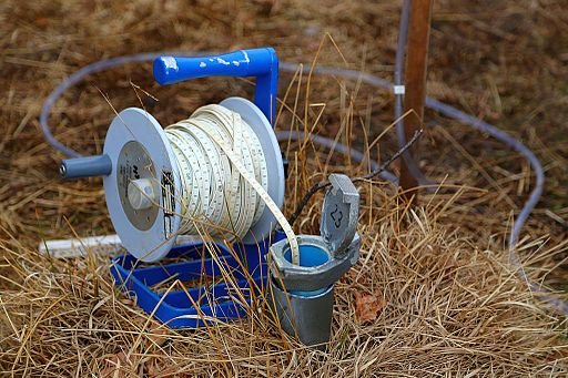
County Well Index
The County Well Index (or CWI) is a database that contains subsurface information for over 533,000 water wells drilled in Minnesota.
CWI is maintained by the MGS in partnership with the Minnesota Department of Health (MDH). The data are derived from well contractors' logs of geologic materials encountered during drilling and later interpreted by geologists at the MGS. Available data also includes casing, screen, and pump information. Confirmed locations and interpreted geologic stratigraphy are available for over 340,000 of the water wells.
Accessing the CWI Database
Both online and offline options are available for accessing the CWI database.
To view and query the database online in either a text-based or map-based interface, click the button below to visit the Minnesota Well Index online portal.
To download offline copies of the CWI database (excluding public supply wells), click the button below for instructions on accessing the MGS FTP site. The database is available as shapefiles, a Microsoft Access database file, and the cwi4VIEW app which can only be run through a 32-bit version of Microsoft Access. CD copies of cwi4VIEW are also available for purchase from the MGS Map Sales Office.
Offline CWI Download Instructions
Due to the homeland security act, the open-access versions do not contain public water supply wells. The MGS does offer a fullset CWI download of the data that includes public water supply wells. If you need the fullset database, please contact Hannah Wilson (Hannah.Wilson@state.mn.us) or Bob Tipping (Bob.Tipping@state.mn.us) at the Minnesota Department of Health and request fullset CWI access.
Data Procedures Manual
The CWI Data Procedures Manual (PDF) was developed to describe data management requirements for Minnesota Unique Well Numbers (Unique Numbers) and associated well location data housed in the database.
These procedures were developed, in partnership with the MGS, by the MN Department of Health (MDH), MN Department of Natural Resources (DNR), MN Pollution Control Agency (MPCA), and MN Department of Agriculture (MDA).
Special thanks to Nila Hines, Todd Petersen, and Linse Lahti at the Minnesota Department of Natural Resources for report management, compilation, and editing.
Frequently Asked Questions
For questions regarding the CWI database, please refer to the CWI FAQs page. This does not include information about the web-based CWI or MWI application. For help pertaining to those, please refer to the Minnesota Well Index (MWI) page in the Related Links section.
