News
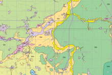
Steele County Atlas, Part A: Geology Published
Posted
The Steele County Atlas, Part A: Geology was recently published, with digital map plates and GIS datasets available online.
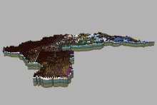
New 3D Geologic Models Published for GRAPS Pilot Project
Posted
Compilation geologic models for the Cannon, Missouri, and Redeye River Watersheds were recently completed as part of a two-year GRAPS Pilot Project in partnership with MDH.
Annual Report 2020-2021
Posted
Our Annual Report for 2020-2021 is now available!
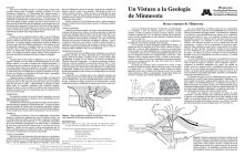
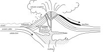
Un Vistazo a la Geología de Minnesota
Posted
Tres publicaciones de la serie "Un Vistazo a la Geología de Minnesota" ahora disponibles en español. [Three "Minnesota at a Glance" publications now available in Spanish.]
Newly Revised Minnesota at a Glance!
Posted
Five newly revised "Minnesota at a Glance" publications are now available, including both 2-page and 4-page layouts.
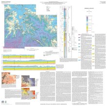
Olmsted County Geologic Atlas, Part A
Posted
The Olmsted County Geologic Atlas - Part A (geology) was recently published by the Survey.
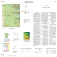
Dodge County Geologic Atlas, Part A
Posted
The Dodge County Geologic Atlas - Part A (geology) was recently published by the Survey.
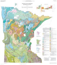
D-01 Surficial Geology Map of Minnesota
Posted
This is the inaugural launch of our D-Series (digital) databases that will be continually updated and made publicly available through the web.