Spatial AI expert to join CS&E faculty this fall

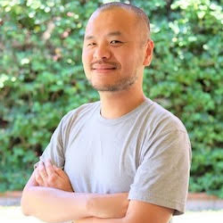
The Department of Computer Science & Engineering is honored to welcome Yao-Yi Chiang as the newest addition to our world-renowned spatial computing faculty. He will officially join the University of Minnesota team as an associate professor at the start of the Fall 2021 semester.
Chiang's research focus is spatial artificial intelligence (AI), and he leverages the unique properties of spatial data to develop machine learning and data mining algorithms to tackle real-world problems. Specifically, he is an expert in digital map processing, pattern recognition, geospatial information systems (GIS), and predictive analytics.
"Professor Chiang brings valuable and timely expertise in GeoAI, a fast growing area of spatial computing with compelling foundational and use-inspired challenges and opportunities," stated Distinguished McKnight University Professor Shashi Shekhar. "He strengthens our data science programs and enhances our ability to compete for grants in the emerging GeoAI initiatives."
Chiang is thrilled for the opportunity to work alongside Professor Shekhar and the rest of his new colleagues.
"I believe the U of M’s CS&E department has the best minds in the area of spatial computing & spatial data science in the country, and I'm ready to be a valuable and complementary addition to this great team," he shared.
In addition to teaching courses in data mining, spatial databases, and mobile GIS, the associate professor will continue to push forward his research in spatial artificial intelligence.
"I plan to seek collaborations within the CS&E department to build transformative capability in AI for tackling spatial data in any form, large sizes, and high velocities," said Chiang. "I also hope to collaborate with experts from across the U of M to apply the developed capabilities to address problems in health, social goods, digital humanities, and agriculture, to name a few."
For instance, he is already planning to network with researchers in other departments and centers, including the Precision Agriculture Center, the Minnesota Population Center, U-Spatial, and the Department of Geography, Environment and Society. He also hopes to learn more about teaching practices, curriculums, and outreach events in other departments to identify opportunities to incorporate spatial and AI components in education for University and K-12 students.
Chiang is currently an associate professor (research) in the Spatial Sciences Institute and Associate Director of the Integrated Media Systems Center at the University of Southern California.
He has published many articles on automatic techniques for geospatial data extraction and integration. For his paper Querying Historical Maps as a Unified, Structured, and Linked Spatiotemporal Source, he won the first place prize at the Computing Community Consortium (CCC) sponsored Blue Sky Ideas Track Competition at the ACM SIGSPATIAL International Conference on Advances in Geographic Information Systems 2015 (SIGSPATIAL 2015). The institutions funding his research include the National Science Foundation (NSF), Defense Advanced Research Projects Agency (DARPA), the National Institutes of Health (NIH), the National Geospatial-Intelligence Agency (NGA), and the National Endowment for the Humanities.
Prior to USC, Chiang worked as a research scientist for Geosemble Technologies (now TerraGo Technologies), which was founded based on a patent of which he was a co-inventor on geospatial-data fusion techniques.